Adventure riding short rides and BS thread

slackmeyer

Well-known member
[GMAP]<iframe width="425" height="350" frameborder="0" scrolling="no" marginheight="0" marginwidth="0" src="http://maps.google.com/maps?f=d&source=s_d&saddr=Tassajara+Rd&daddr=Tassajara+Rd&hl=en&geocode=FX9wKwIdp9LA-A%3BFVfxKAIdOUvB-A&mra=mift&mrsp=1&sz=14&sll=36.229527,-121.539516&sspn=0.044726,0.090895&ie=UTF8&ll=36.229527,-121.539516&spn=0.044726,0.090895&output=embed"></iframe><br /><small><a href="http://maps.google.com/maps?f=d&source=embed&saddr=Tassajara+Rd&daddr=Tassajara+Rd&hl=en&geocode=FX9wKwIdp9LA-A%3BFVfxKAIdOUvB-A&mra=mift&mrsp=1&sz=14&sll=36.229527,-121.539516&sspn=0.044726,0.090895&ie=UTF8&ll=36.229527,-121.539516&spn=0.044726,0.090895" style="color:#0000FF;text-align:left">View Larger Map</a></small>[/GMAP]

Here's a map. It's easy to find, and a fun little road- especially if you like riding carmel valley anyway.
 

Busy Little Shop

Man behaving bikely...
Awesome story Larry! You wrote this in 72 while in college??? That makes you older then me and I'm AARP eligible. And here I thought I was the oldest BARF member ever.

Thanks Duke... I wrote it in 88 when I retired from the USAF and began my
college education... I'm AARP eligible too... in fact a 62 rider may scare some the
young ones if they never been around someone this old before...
 

ratpick

Well-known member
Here's the ex duke drz up on coastridge rd today with the dirt wheels on..(it's not for sale:teeth)
 

Attachments

  • more views.jpg
    more views.jpg
    93.8 KB · Views: 111
  • nacimiento side of coast ridge rd.jpg
    nacimiento side of coast ridge rd.jpg
    155.9 KB · Views: 116
  • on top of the ridge.jpg
    on top of the ridge.jpg
    87.4 KB · Views: 116

ratpick

Well-known member
This is meant to be a general purpose adventure riding thread, a repository of random photos of rides not worthy of elaborate reports, a place to mention great rides that you didn't take any good pictures of, a place to get advice or give advice about camping, road conditions, gear, etc, and (if you must), a place to tell us why your bike is great and all others are inferior.

Let's give it a go:

I bundled up yesterday to give Tassajara road a try- it's becoming something of a winter tradition. As expected, I didn't get very far:
IMG_4424.JPG


Here's last year up at the top:
tassajara%20ride%20001.JPG


Hwy 25 was fun on the way back though:
IMG_4425.JPG


zak
I went up there last year in the snow,didn't get very far either,the distanzias were sliding all over the place.:laughing
 

209ktmdude

The Orange Ones Go Faster
Here's the ex duke drz up on coastridge rd today with the dirt wheels on..(it's not for sale:teeth)

Do you have a map of this road? Looks like it goes for miles. Haven't been on it yet and would love to give it a try.
 

slackmeyer

Well-known member
Had some fun up north today, got lost on low gap road out of Ukiah. Just got to get some pics off the camera and I'll put them up. . .
 

ratpick

Well-known member
Do you have a map of this road? Looks like it goes for miles. Haven't been on it yet and would love to give it a try.

easy to get to,south of big sur about 30 miles to nacimiento rd,follow nacimiento to the top and coast ridge/los burros rd is on the right.
It is about 15 miles long.
 

slackmeyer

Well-known member
[GMAP]<iframe width="425" height="350" frameborder="0" scrolling="no" marginheight="0" marginwidth="0" src="http://maps.google.com/maps?f=d&source=s_d&saddr=1435+Santa+Fe+Avenue,+Berkeley,+CA&daddr=38.61012,-122.77387+to:38.81892,-122.86853+to:39.0468807,-123.131902+to:39.1803167,-123.3158638+to:39.20984,-123.76837+to:Flynn+Creek+Rd+to:39.2333701,-123.3701536+to:39.07961,-123.21582+to:38.91413,-123.25647+to:38.22852,-122.6393+to:38.1544898,-122.6977778+to:38.0521723,-122.6467718+to:San+Rafael,+CA&geocode=FVH6QQIdofm1-CkbV6abyH6FgDGKnbewsOliCQ%3BFcgkTQIdkp6u-ClRcQqEUhSEgDHpm1l0x3gBXQ%3BFWhUUAIdziyt-Cm1ea_CUQiEgDEBidk4L407hA%3BFeDOUwIdAiip-ClZFHW_MV6BgDF_ZE0B8CEEGg%3BFRzYVQIdaVmm-CmjsW_Lp3GBgDFe2BF-aI82eg%3BFXBLVgIdznGf-CkDP3GtbquBgDGuYTDh0XDQ0w%3BFaoaVwIddhyi-A%3BFVqnVgIdV4Wl-CmxagIxJXSBgDFEl-2SJ92O1w%3BFbpOVAIdNOCn-Cnb7jTOWGaBgDFTm74wWNhArw%3BFVLIUQIdakGn-CkLYDmXMluBgDEe2fsHYGnqxw%3BFShSRwIdPKyw-Cm1Oi9jr7aFgDEenaUMBJ-MpA%3BFfkwRgIdz8ev-Cl3Vxi87LeFgDGM7oHLnblQ5w%3BFUyhRAIdDY-w-Cm1HlZSjL6FgDGfx7sJ1YpdsQ%3BFR9uQwId8VKy-Ckvegk2Z5eFgDFUJuLmIE0Bvg&hl=en&mra=dpe&mrsp=9&sz=11&via=1,2,3,4,5,7,8,9,10,11,12&sll=39.045853,-123.291321&sspn=0.344497,0.727158&ie=UTF8&ll=39.045853,-123.291321&spn=0.344497,0.727158&output=embed"></iframe><br /><small><a href="http://maps.google.com/maps?f=d&source=embed&saddr=1435+Santa+Fe+Avenue,+Berkeley,+CA&daddr=38.61012,-122.77387+to:38.81892,-122.86853+to:39.0468807,-123.131902+to:39.1803167,-123.3158638+to:39.20984,-123.76837+to:Flynn+Creek+Rd+to:39.2333701,-123.3701536+to:39.07961,-123.21582+to:38.91413,-123.25647+to:38.22852,-122.6393+to:38.1544898,-122.6977778+to:38.0521723,-122.6467718+to:San+Rafael,+CA&geocode=FVH6QQIdofm1-CkbV6abyH6FgDGKnbewsOliCQ%3BFcgkTQIdkp6u-ClRcQqEUhSEgDHpm1l0x3gBXQ%3BFWhUUAIdziyt-Cm1ea_CUQiEgDEBidk4L407hA%3BFeDOUwIdAiip-ClZFHW_MV6BgDF_ZE0B8CEEGg%3BFRzYVQIdaVmm-CmjsW_Lp3GBgDFe2BF-aI82eg%3BFXBLVgIdznGf-CkDP3GtbquBgDGuYTDh0XDQ0w%3BFaoaVwIddhyi-A%3BFVqnVgIdV4Wl-CmxagIxJXSBgDFEl-2SJ92O1w%3BFbpOVAIdNOCn-Cnb7jTOWGaBgDFTm74wWNhArw%3BFVLIUQIdakGn-CkLYDmXMluBgDEe2fsHYGnqxw%3BFShSRwIdPKyw-Cm1Oi9jr7aFgDEenaUMBJ-MpA%3BFfkwRgIdz8ev-Cl3Vxi87LeFgDGM7oHLnblQ5w%3BFUyhRAIdDY-w-Cm1HlZSjL6FgDGfx7sJ1YpdsQ%3BFR9uQwId8VKy-Ckvegk2Z5eFgDFUJuLmIE0Bvg&hl=en&mra=dpe&mrsp=9&sz=11&via=1,2,3,4,5,7,8,9,10,11,12&sll=39.045853,-123.291321&sspn=0.344497,0.727158&ie=UTF8&ll=39.045853,-123.291321&spn=0.344497,0.727158" style="color:#0000FF;text-align:left">View Larger Map</a></small>[/GMAP]
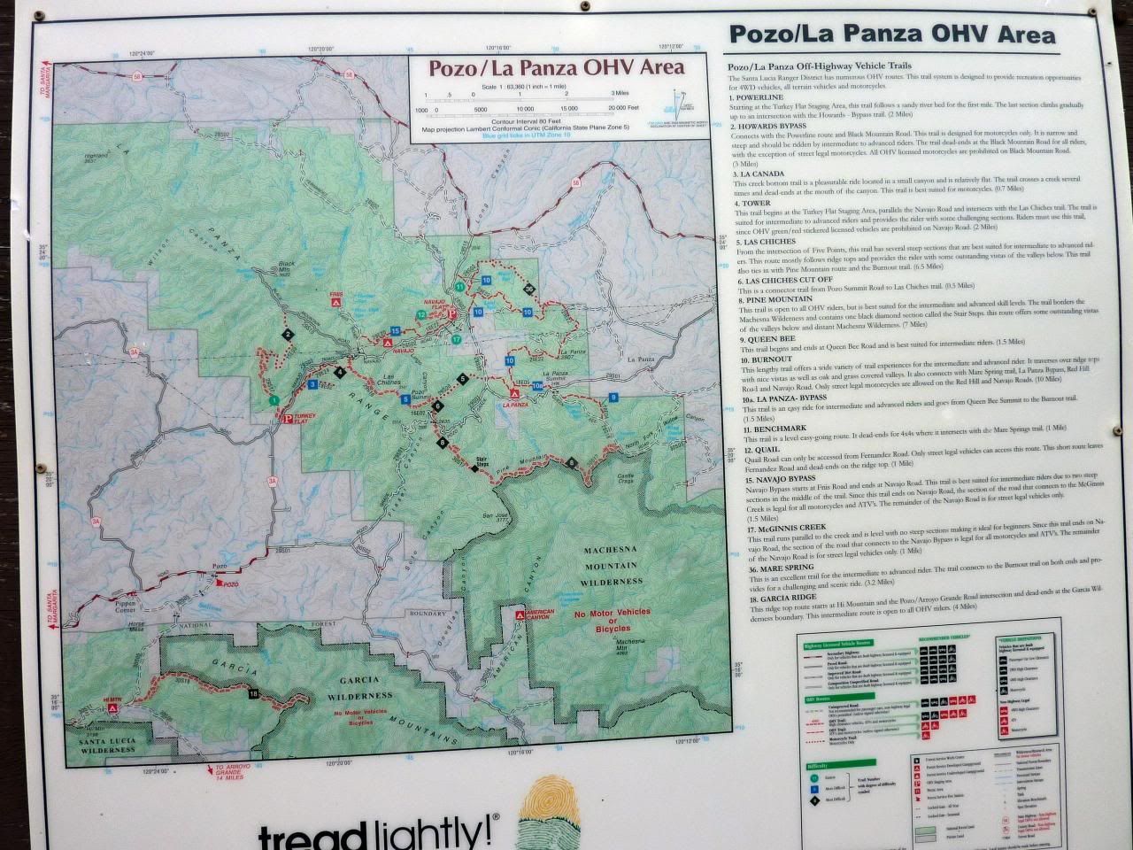
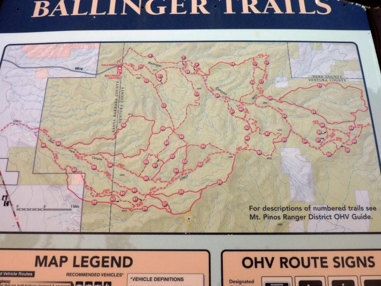
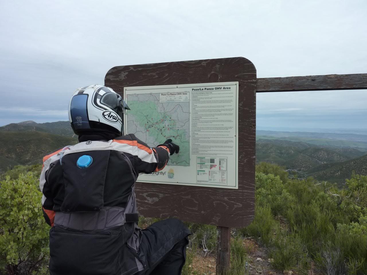
Yesterday's ride:
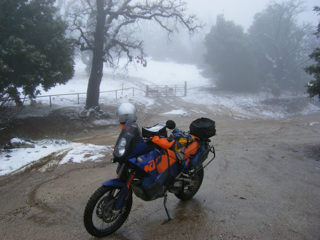
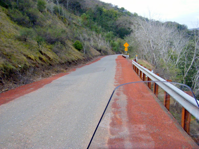
Geysers road- Thank dog for red sand. kudos to sonoma county roads.
DSCF9509.JPG


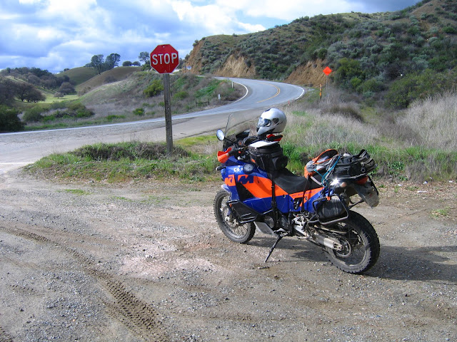
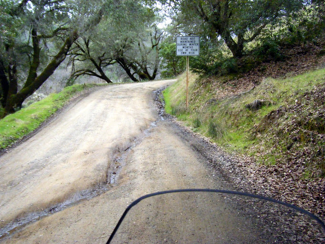
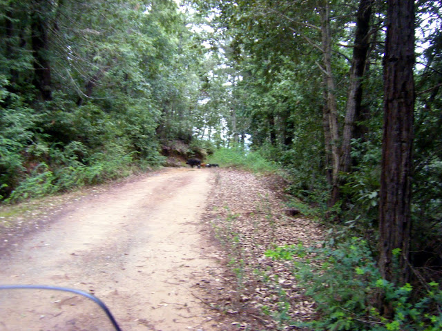
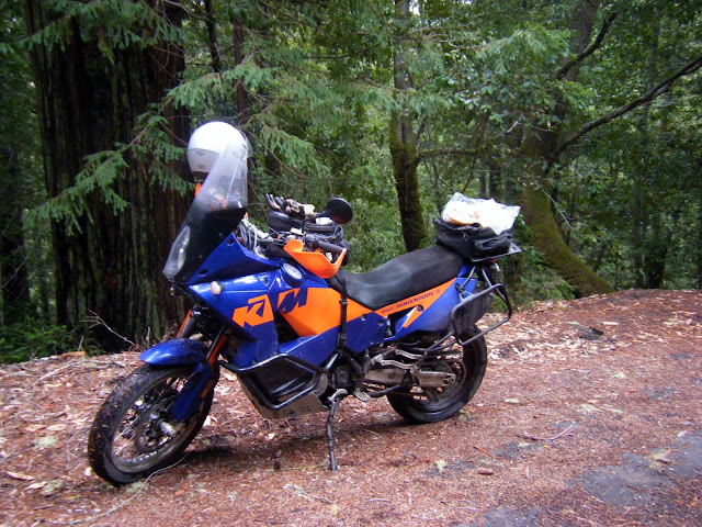
Low Gap road- I thought I was going to do an all pavement ride, so I had sport touring tires/wheels on. But low gap road was calling my name- I'd never been on it, but heard about it for years.
DSCF9511.JPG


Boars and Boarlets- I saw a bunch of them:
DSCF9516.JPG


DSCF9515.JPG


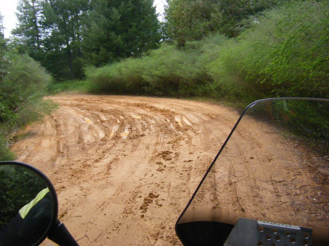
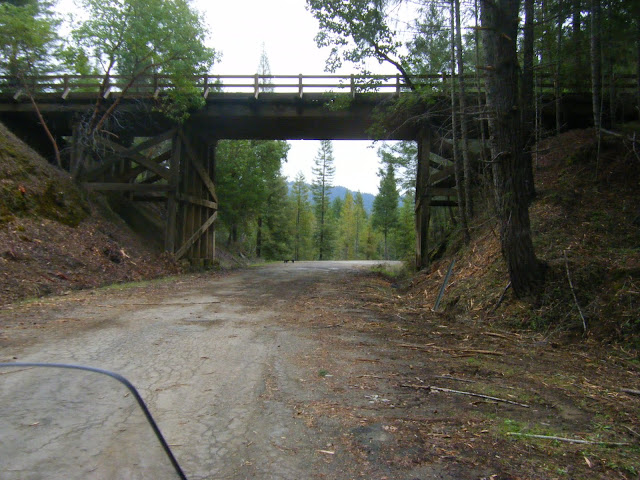
It got muddy. I went past this spot, about 12 miles in, and got to a very rutted out muddy downhill. I could have ridden down it, but I don't think I could have come back up if things got bad later on. So I turned around, and decided to head over to a paved road I saw a mile or so back:
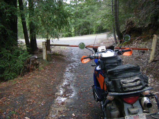
DSCF9518.JPG


Hmmm. . . .
DSCF9519.JPG


So, I went around that gate, thinking I'd end up on paved FS road that led me to Orr springs road. No such luck. I ended up riding down masonite industrial road, having to go around another gate, much trickier than this one, and then meeting a guy from Mendocino Redwood Co., who scolded me for trespassing, took down my info, and let me out onto hwy 128, near flynn creek road.

DSCF9520.JPG

That's low gap road up there, where I should be. Note more piglets on the pavement ahead.

Around that time, it started raining, so I looped around to Albion and Comptche, then back to Ukiah, and spent the rest of the day riding around on nice (but wet) pavement. And noticed that my tires are especially slippery on wet paint and tar.

Lunch of leftover pizza somewhere on Fish Rock road:
DSCF9521.JPG


zak
 

WoodsChick

I Don't Do GPS
Nice photos, Zak! :thumbup My sister used to live out near Comptche and I've done some really run riding out there on Flynn Creek and Comptche-Ukiah Rds. Good stuff! That mud didn't look all that fun, though...:laughing


WoodsChick
 

WoodsChick

I Don't Do GPS
I spent last weekend doing day rides out of camp on the Carrizo Plain. I should probably get off my lazy butt and post up a real ride report, but until then this thread has given me permission
to be lazy :) We did some high-speed pavement, goat-trail pavement,
dirt-with-a-few-patches-of-pavement pavement, gravel, high-speed dirt roads, 4x4 roads, 4x4 trails, singletrack, rocks...
just a little bit of everything, really. We rode some of Ballinger Canyon
and Pozo and lots of stuff in between. Have I mentioned lately how
much I love my SM610? Well, I really do...:love

Oh yeah, I had a :bday too :party

IMG_0054.jpg


P1030918.jpg


P1030965.jpg


P1030985.jpg


P1030898.jpg


P1030954.jpg


P1030997.jpg


I'll probably put a ride report together soon...


WoodsChick
 

209ktmdude

The Orange Ones Go Faster
Woodschick, where is that located at? Looks nice If you can post a route map that would be great. Looks like tons of 2-3 day riding
 
Last edited:

WoodsChick

I Don't Do GPS
Woodschick, where is that located at? Looks nice If you can post a route map that would be great. Looks like tons of 2-3 day riding

:laughing Dude, seriously...you need to get yourself a Benchmark Road and Recreation Atlas as soon as possible. Really. Leave it by your toilet and look it every chance you get. I find these places in the exact same manner. Well...minus the toilet bit:) I stated that I staged out of Carrizo Plain, and I rode Ballinger Canyon and Pozo. With those kinds of clues it's pretty easy to know where it's located. And yeah, there is a ton of riding to be had down there, any flavor you choose :ride

I don't mean to sound like a bitch or anything, and I don't mean to come off as unhelpful, but for me half the fun of riding these places is finding them on maps and saying to myself "Ooh! I didn't realize Pozo was so close to the Carrizo Plain National Monument! Let's go there!" and then we go there, and it's a revelation.

Here's some more detailed information for you :thumbup

P1030978.jpg


P1030936.jpg


P1030900.jpg


WoodsChick
 

DukeD

AARP eligible
:
I don't mean to sound like a bitch or anything, and I don't mean to come off as unhelpful, but for me half the fun of riding these places is finding them on maps and saying to myself "Ooh! I didn't realize Pozo was so close to the Carrizo Plain National Monument! Let's go there!" and then we go there, and it's a revelation.

Hi Woodschick,

Nice ride, I'm looking online for the Benchmark Road and Recreation Atlas and there are a few different publication dates varying from 97, 02, and 04 with price changes to match. Does it make a big difference in the pub date or should I just get one, any one. Also, your photos look like they are lamenated and the only ones I see for sale are paperback, did you buy yours in a full lamenated version or did you do it yourself to take with you on the trail?

Thanks again for the post, looks like a great ride. :thumbup
 

209ktmdude

The Orange Ones Go Faster
Woodschick, thank you for your response. And how did you know I take my ATlas in the bathroom with me?..lol I have poured over it but obviously I am new to the areas of riding south of me. Thank you for the pics though, they helped a lot.
 

mnb

Obliterates Stereotypes
Thank you for the pics though, they helped a lot.

+1

Scribbles on a map don't mean much, but photos tell a story.


BTW, in this pic of the short, rugged climb where the bike is stopped at the bottom, contemplating the line...
P1030965.jpg

Is that a nasty step up in the middle or just some rugged rock? The former would make it a bit tricky of a hill climb and the latter would make it something I could probably do... :)

One thing I hate about pictures and video. They flatten things out. Those ruts don't look as deep. That step up looks minimal, the steepness of that descent or climb looks nearly flat.
 

WoodsChick

I Don't Do GPS
Hi Woodschick,

Nice ride, I'm looking online for the Benchmark Road and Recreation Atlas and there are a few different publication dates varying from 97, 02, and 04 with price changes to match. Does it make a big difference in the pub date or should I just get one, any one. Also, your photos look like they are lamenated and the only ones I see for sale are paperback, did you buy yours in a full lamenated version or did you do it yourself to take with you on the trail?

Thanks again for the post, looks like a great ride. :thumbup

Hey, Duke! My CA Benchmark has a pub date of 2005. I don't know what the difference is but with the way things change here in CA in regards to access I would probably go for the most current version possible. My NV Benchmark has a pub date of 2003 but it is extremely accurate.

The trail map photos were laminated. They were attached to signs at the OHV areas :laughing You can see the Ballinger Canyon sign in the 5th photo above, and this is what the Pozo/La Panza one looked like...

P1030935.jpg


I usually call up the closest ranger station for the area I'll be riding and ask them to send me a trail map. This trip was kind of spur-of-the-moment though, so I didn't have time. I took the close-up photos of the maps so I could zoom in on them with my camera and use them as digital maps while riding. I usually do that anyway just in case, whether I have a map or not :nerd

As for the Benchmark maps, I used to make color copies of the pages I'd need and then take those with me on the bike. It got to be expensive so I just take them out of the book and put them in a map case now. You can see the mapcase on Eric's bars in the Ballinger photo. It's been working fine for a few years. Clear Contact paper works great for laminating maps on the cheap :teeth


WoodsChick
 
Top