You are using an out of date browser. It may not display this or other websites correctly.
You should upgrade or use an alternative browser.
You should upgrade or use an alternative browser.
Oroville to Quincy road closure ?
- Thread starter fuldog
- Start date
bluegixxer600
Well-known member
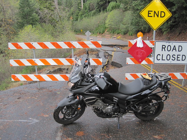
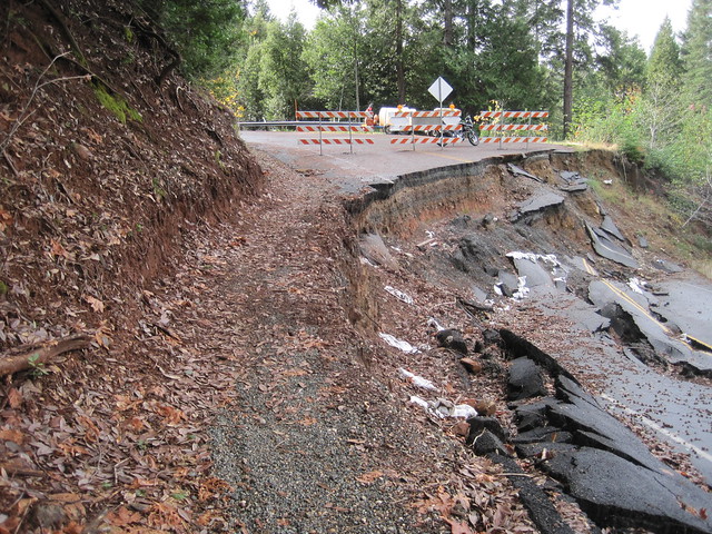
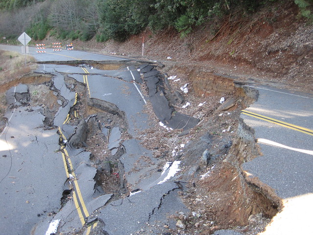
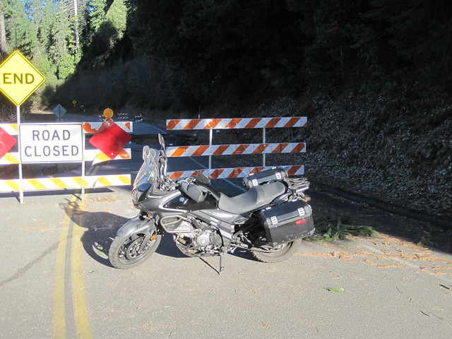
I have squeezed past the washout along the shoulder, just don't look down into the big hole where the road used to be. Next mile or two was covered in leaves and pine needles due to lack of traffic, then it was perfect! Had the road all to myself.
I have squeezed past the washout along the shoulder, just don't look down into the big hole where the road used to be. Next mile or two was covered in leaves and pine needles due to lack of traffic, then it was perfect! Had the road all to myself.
Thanks for all the info. Heading for Bucks lake in 3 weeks. Think a couple of gold wings could squeeze by ? BTW where is the washout ?
sckego
doesn't like crashing
Thanks for all the info. Heading for Bucks lake in 3 weeks. Think a couple of gold wings could squeeze by ? BTW where is the washout ?
Don't fall.
https://www.youtube.com/watch?v=CYWgVSDugB8&feature=youtu.be
shouldnthave
Taze away, Yana...
:wow That's a tight squeeze!
dravnx
Well-known member
There was still a few inches to the left, bags didn't even touch.
Could'a been tighter
What you do and what normal, sane people do is entirely different.
EastBayDave
- Kawasaki Fanatic -
my bud who lives near the highway says the traffic has decreased by about 80%, but the sport bikes still are still going by...
(he's a non-rider.) :teeth :thumbup
"Yeah Saturdays & Sundays/especially Sun. morning, they go by like this: waaa, waaaaaaa, waaaaaa, broom broom broom, waaa waaa." I can hear them going up the mountain for miles..."
(he's a non-rider.) :teeth :thumbup
norcalkid
Well-known member
my bud who lives near the highway says the traffic has decreased by about 80%, but the sport bikes still are still going by...
(he's a non-rider.) :teeth :thumbup
That's kinda the main route for the Chico Riders group. We used to ride it almost every weekend. It was washed out back then too (in what looks like a different spot).
Last edited:
EastBayDave
- Kawasaki Fanatic -
Interesting; apparently they are still getting by on that narrow shoulder on the left. He heard they are not going to fix it until next spring as the states priorities (Hwy 1-Big Sur/etc.) is still going into winter.That's kinda the main route for the Chico Riders group. We used to ride it almost every weekend. It was washed out back then too (in what looks like a different spot).
{Also, this guy got me into dirtbikes about 1962', he & Bros rode them around here; later in the 70's on his Dads ranch in Auburn. Got me my 1st rides on mini-bikes, HON trails 50's/70's, etc. He stopped riding in the late 70's because marriage/ kids, but says every time they go by he wants back on a bike. I beat him up every time we talk he needs to get a bike! Groups of bikes roaring by would drive me nuts! :laughing }
norcalkid
Well-known member
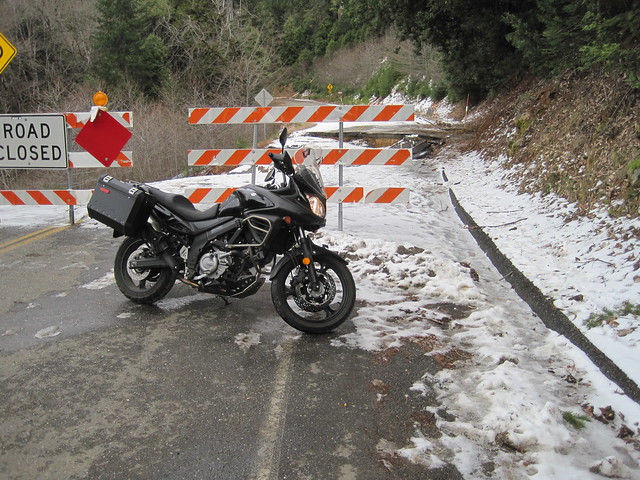
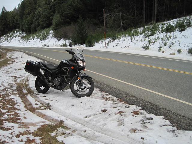
Rode 162 up to Quincy and back down on 70 today. Road past the washout was slick, still a little wet with leaves and pine needles on it from lack of use. Really washout-Quincy was wet and slick. Felt the bike "move" on me a few times. Really didn't want to go down out there where there is very little traffic coming by to find me. Was happy to get to 70 where the traffic dried the road.
The washout was easy to get around on a smaller bike, it's wide enough. No signs of any repairs being done.
 IMG_6597 by Norcalkid, on Flickr
 IMG_6599 by Norcalkid, on Flickr
The washout was easy to get around on a smaller bike, it's wide enough. No signs of any repairs being done.
IMG_6597 by Norcalkid, on Flickr
IMG_6599 by Norcalkid, on Flickr
Last edited:
norcalkid
Well-known member
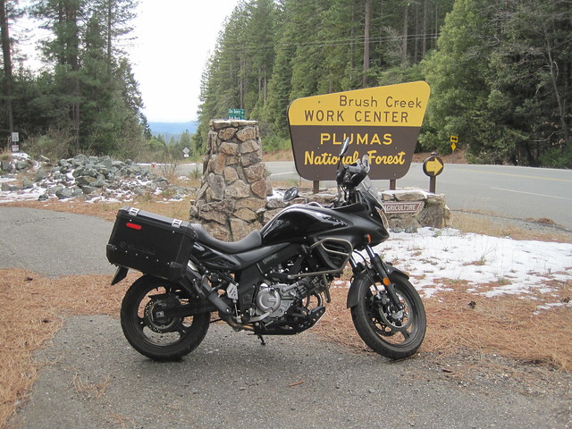
A few more pics from today.
 IMG_6629 by Norcalkid, on Flickr
 IMG_6628 by Norcalkid, on Flickr
 IMG_6631 by Norcalkid, on Flickr
Water in lake is super low with all the Dam issues. This is the launch ramp off 162 where that horse camp place is.
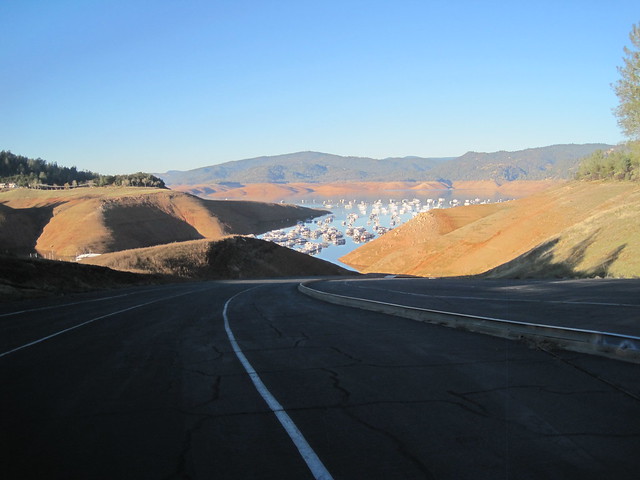 IMG_6636 by Norcalkid, on Flickr
This is a launch ramp over by Feather Falls.
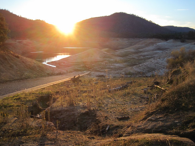 IMG_6637 by Norcalkid, on Flickr
IMG_6629 by Norcalkid, on Flickr
IMG_6628 by Norcalkid, on Flickr
IMG_6631 by Norcalkid, on FlickrWater in lake is super low with all the Dam issues. This is the launch ramp off 162 where that horse camp place is.
IMG_6636 by Norcalkid, on FlickrThis is a launch ramp over by Feather Falls.
IMG_6637 by Norcalkid, on Flickrnorcalkid
Well-known member
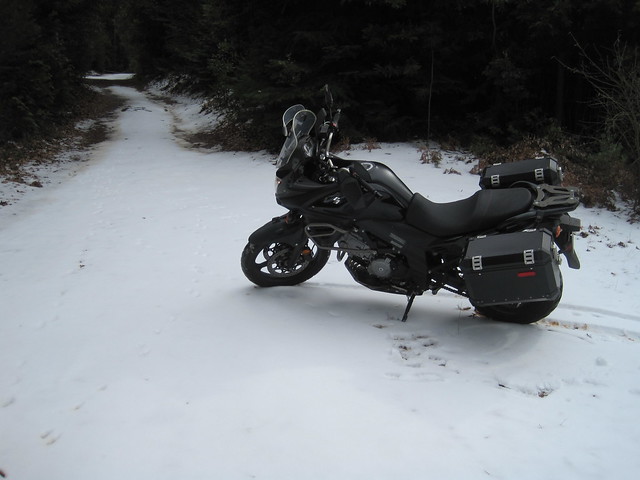
There is also the fire road detour that feels like it is about 4 miles long. (if you don't like the single track). Given an adventure bike, both options have the advantages and disadvantages.
Flip
Went a little ways up the detour a couple days ago. It's super well maintained, the part I was on you could easily ride a GW on(not that I have ever rode one). Not sure if it gets worse further up.
Someone placed a bunch of flyers explaining the detour route since last time I was up there. You just rip one off and follow the directions.
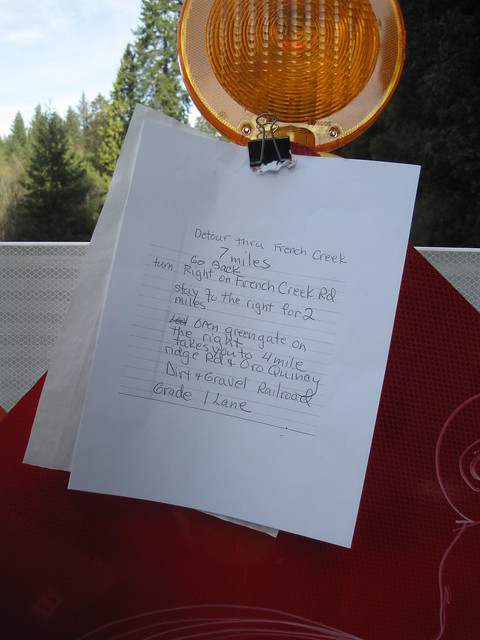 IMG_6648 by Norcalkid, on Flickr
Last edited:
EastBayDave
- Kawasaki Fanatic -
Sure as shit CALTRANS couldn't help & provide detour info....Went a little ways up the detour a couple days ago. It's super well maintained, the part I was on you could easily ride a GW on(not that I have ever rode one). Not sure if it gets worse further up.
Someone placed a bunch of flyers explaining the detour route since last time I was up there. You just rip one off and follow the directions.
 twofinger