Dusy Ershim Trail Photos

WoodsChick

I Don't Do GPS
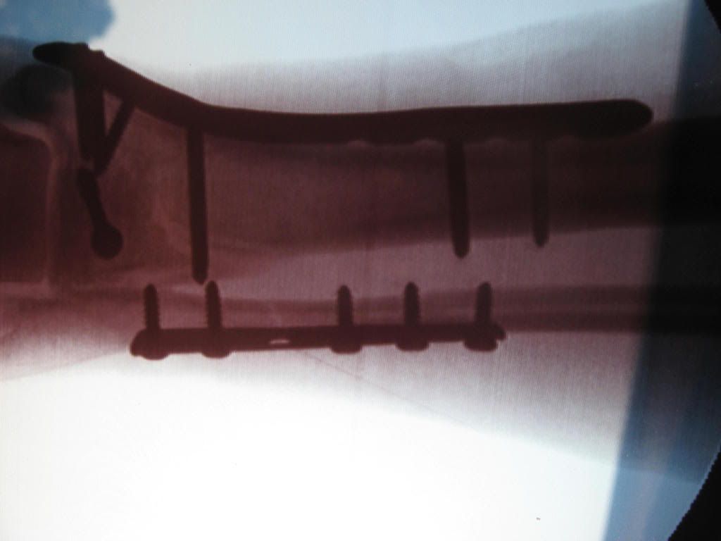
I figured since I'm at home bored out of my mind while my broken bones heal, I may as well post some photos of another Dusy Ershim Ride I did. It's a jeep trail much like the Rubicon, but's it's a blast on a dirtbike. If you've never heard of the Dusy Ershim Trail, there's a good description of it here in my first Dusy ride report...

http://www.bayarearidersforum.com/forums/showthread.php?t=219160

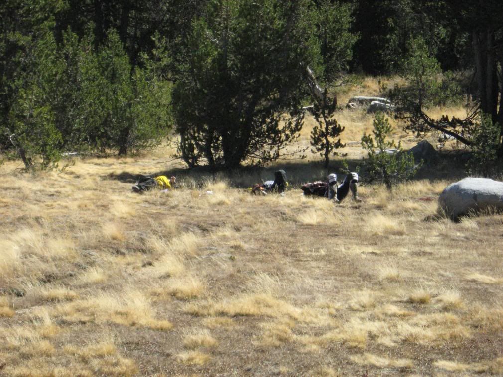
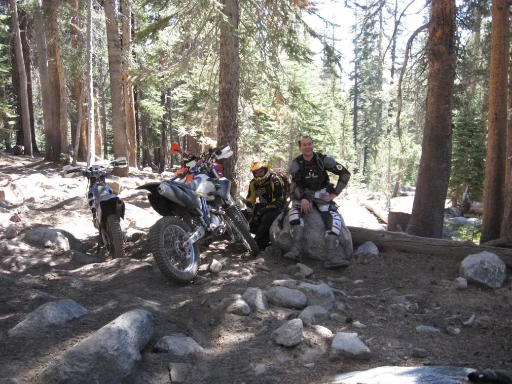
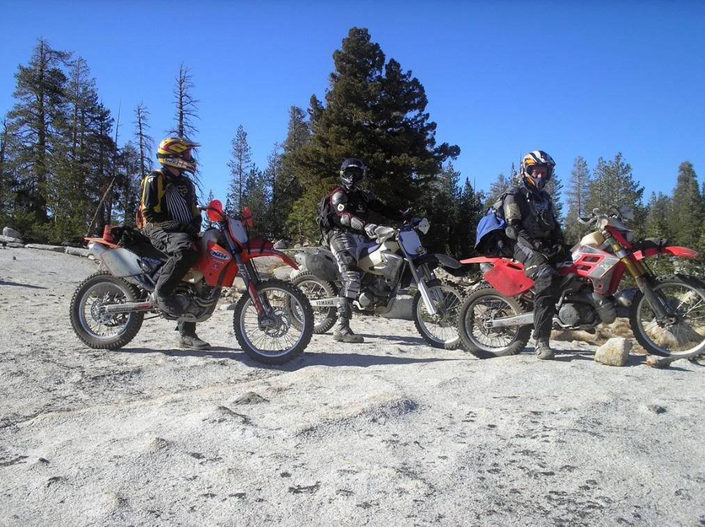
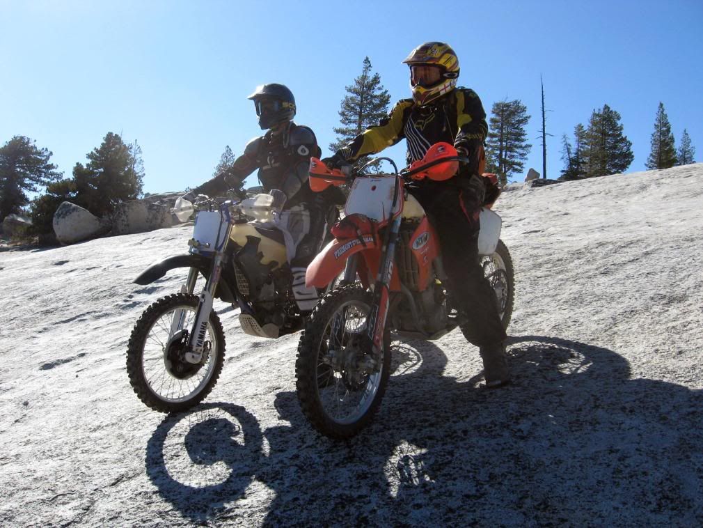
The crew this time consisted of myself on the blue GasGas, Eric on the red GasGas, Dan on his YZ250F, and Steve on his KTM...

IMG_0250.jpg


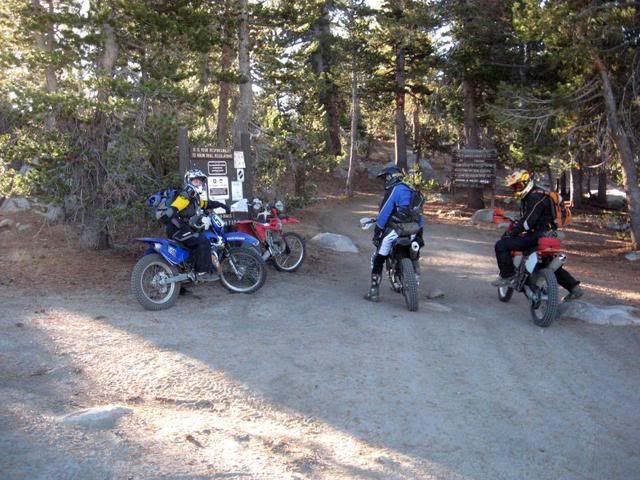
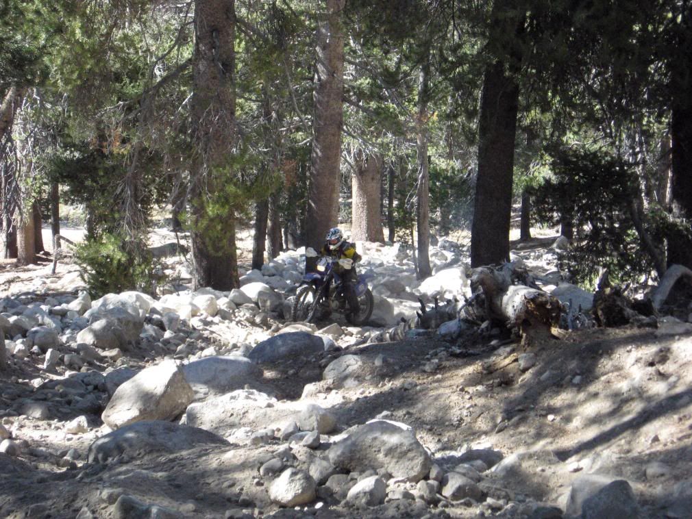
The trail starts at about 9600' ...

IMG_0251.jpg


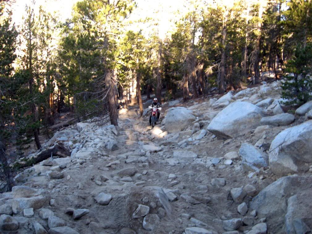
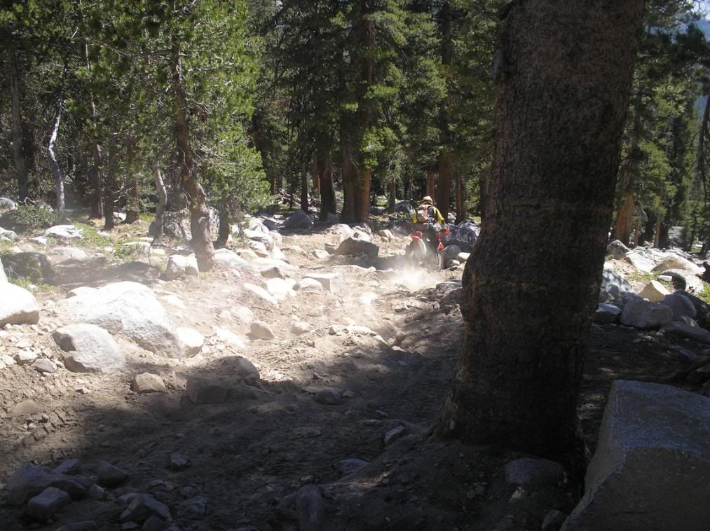
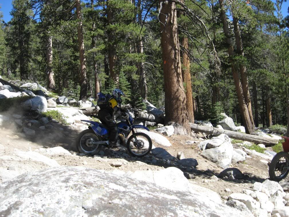
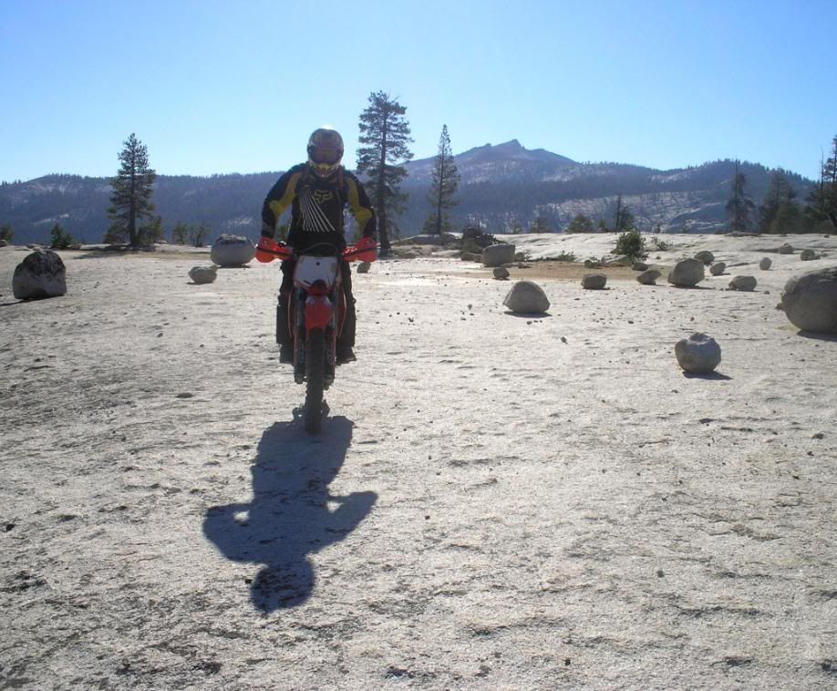
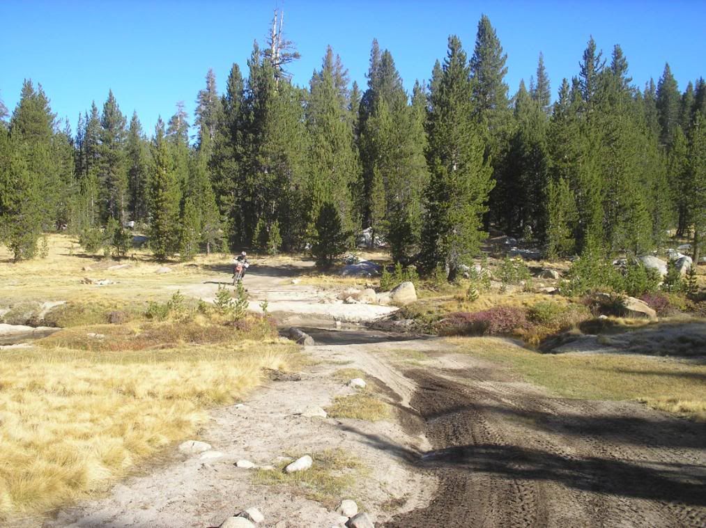
And climbs to a little over 10000' before leveling off at about 9800' for awhile. It was not fun climbing into the sun first thing in the morning...

P9300043.jpg


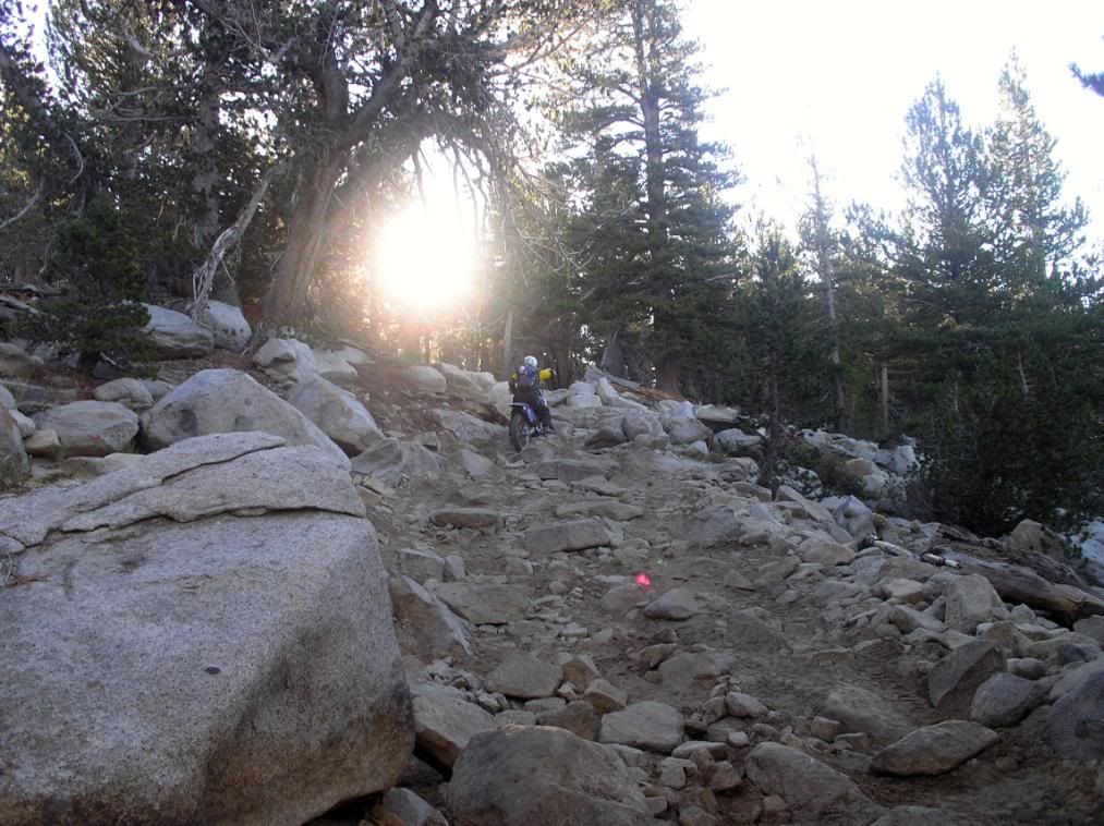
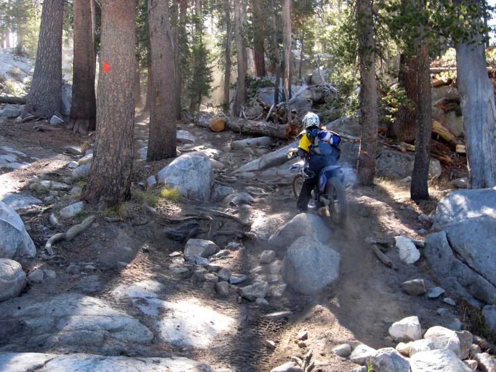
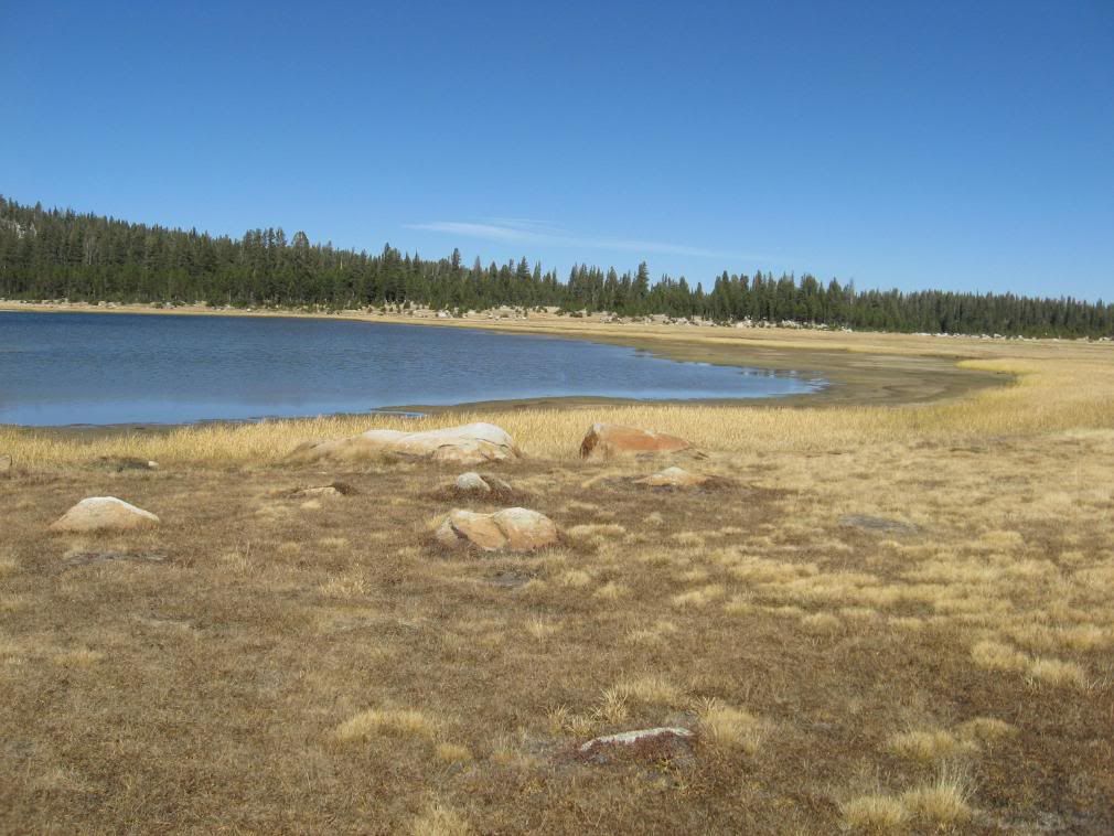
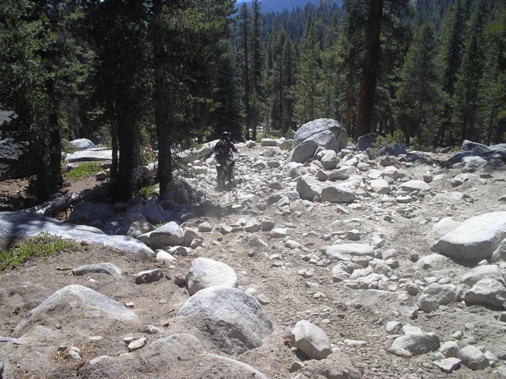
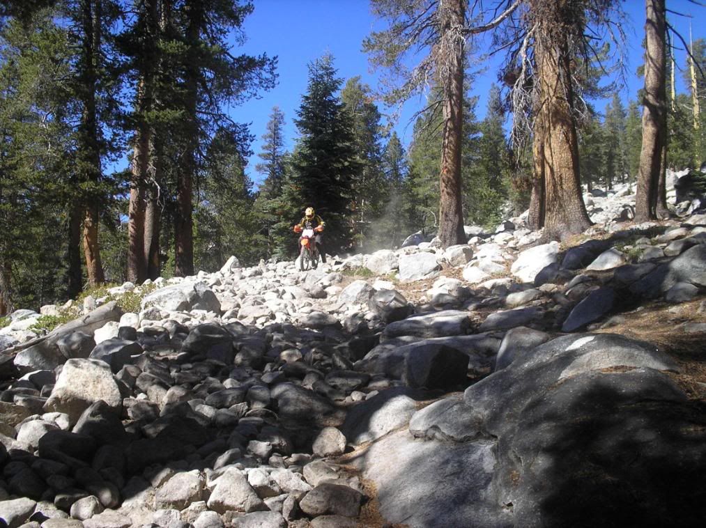
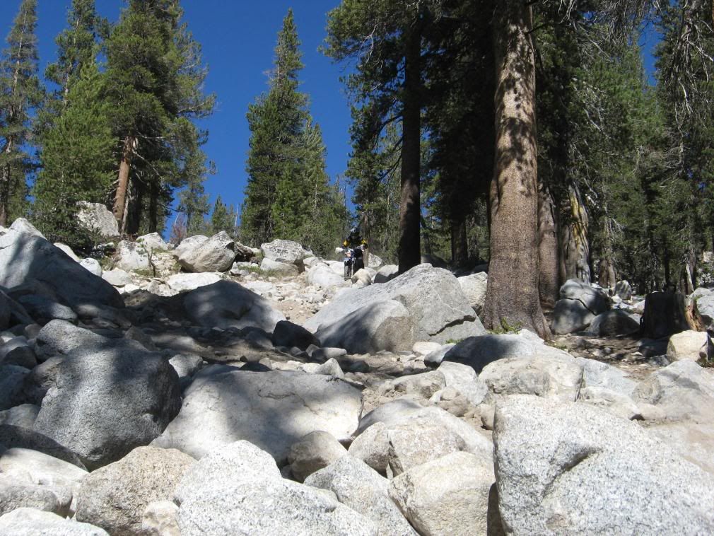
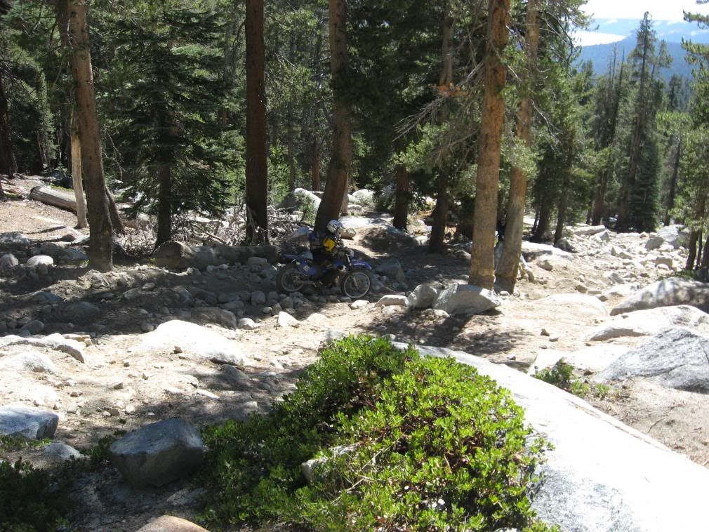
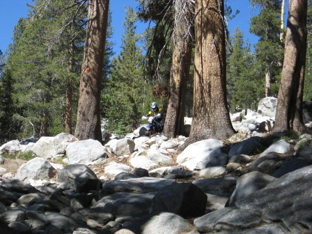
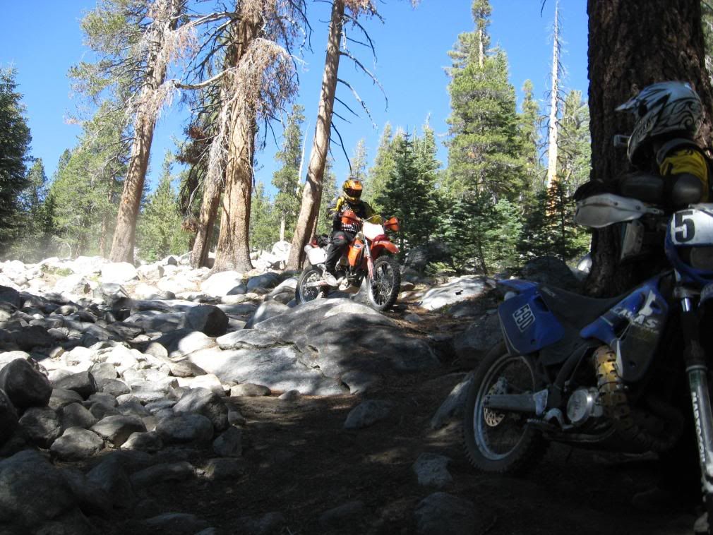
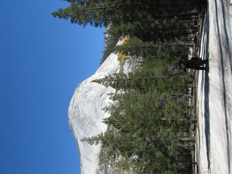
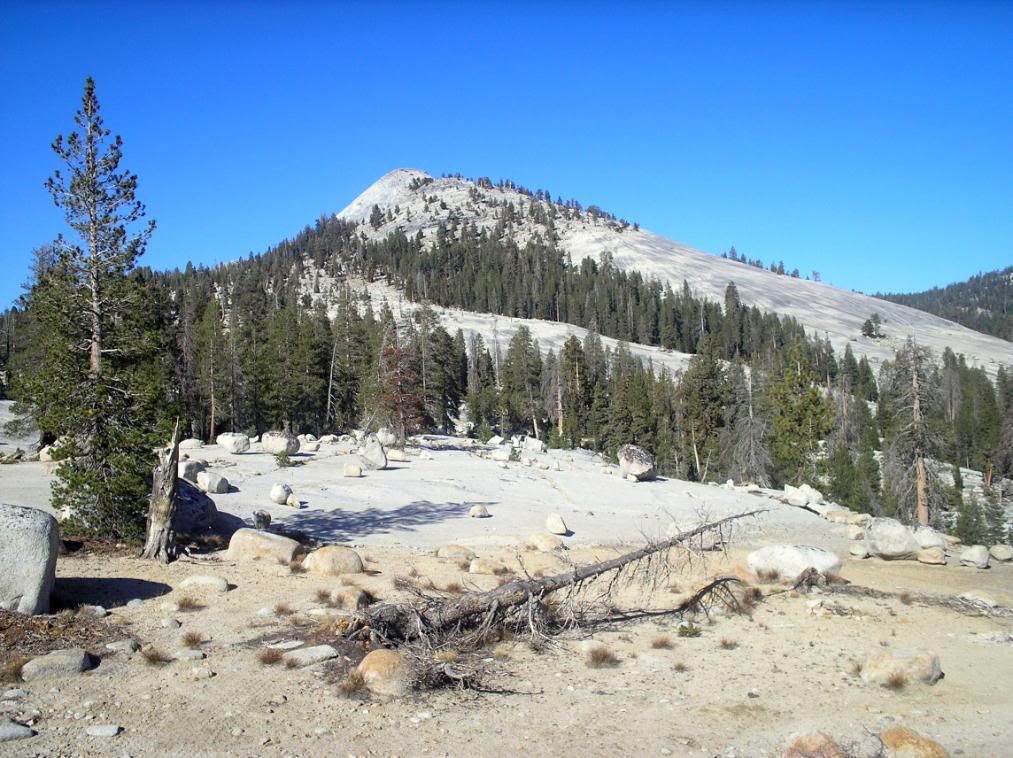
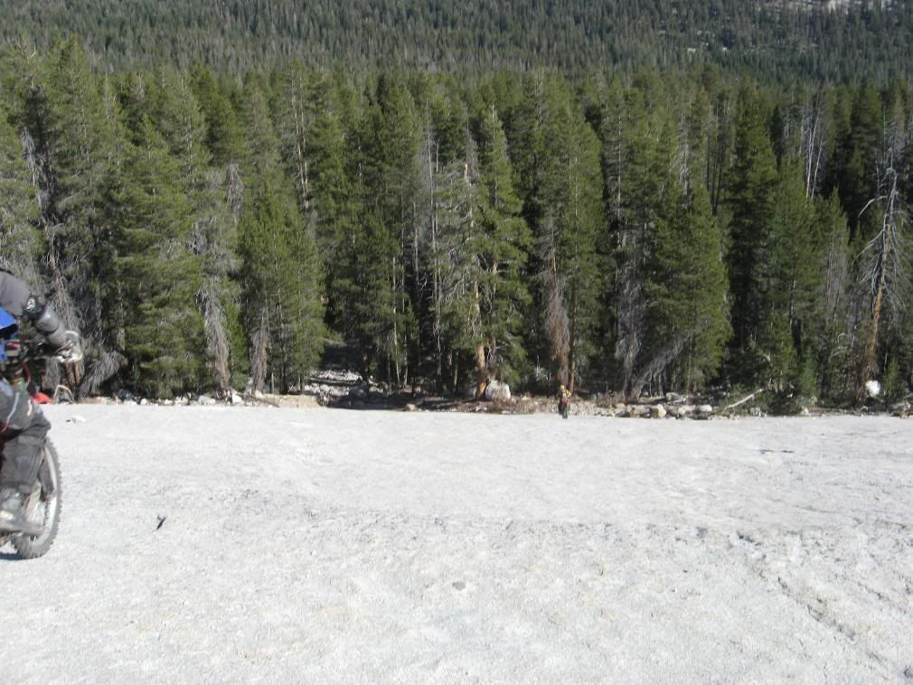
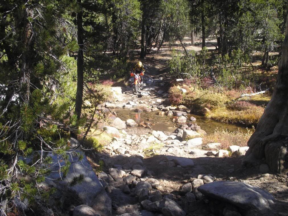
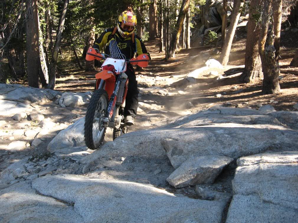
Once the trail levels out, things get a little easier and a lot more scenic...

P9300047.jpg


P9300045.jpg


IMG_0256.jpg


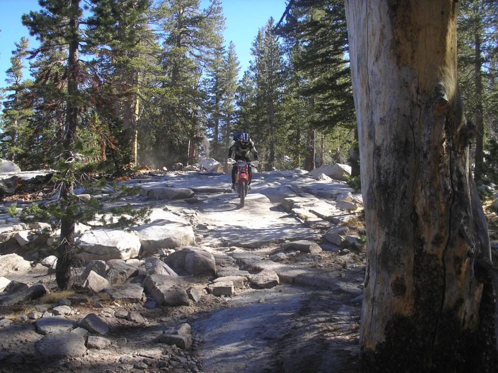
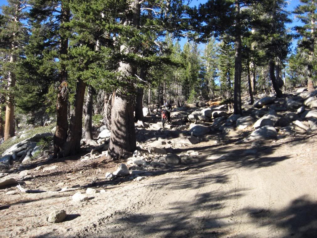
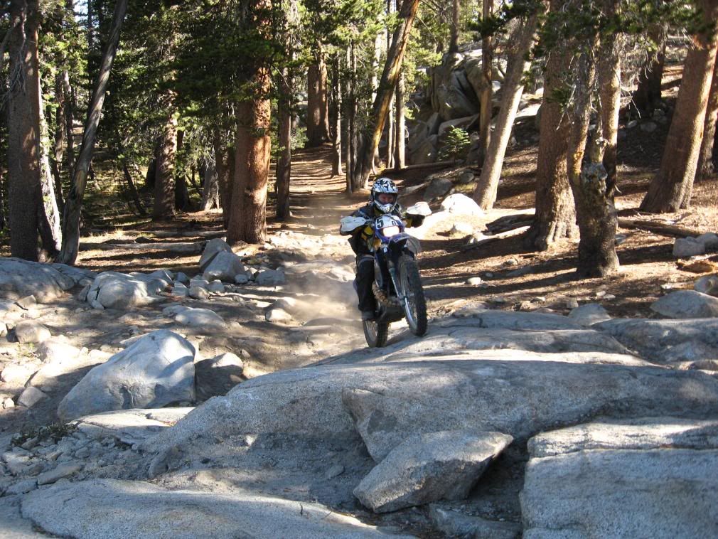
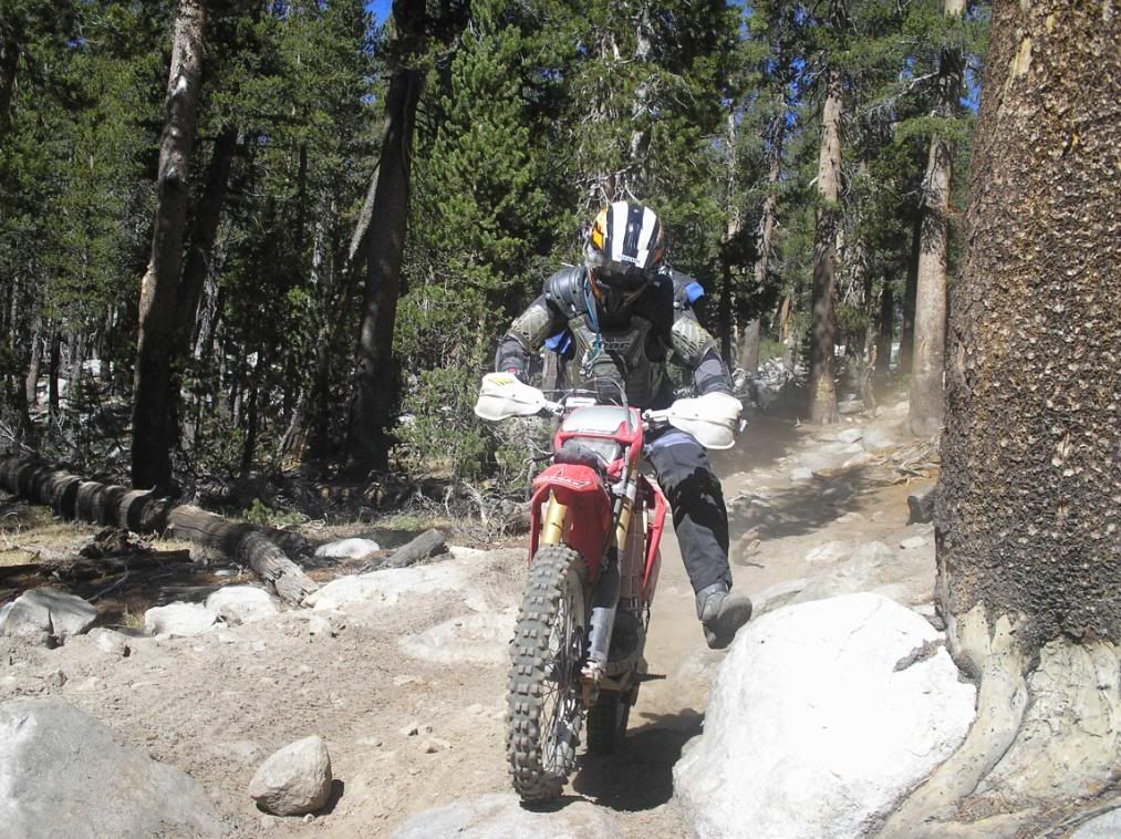
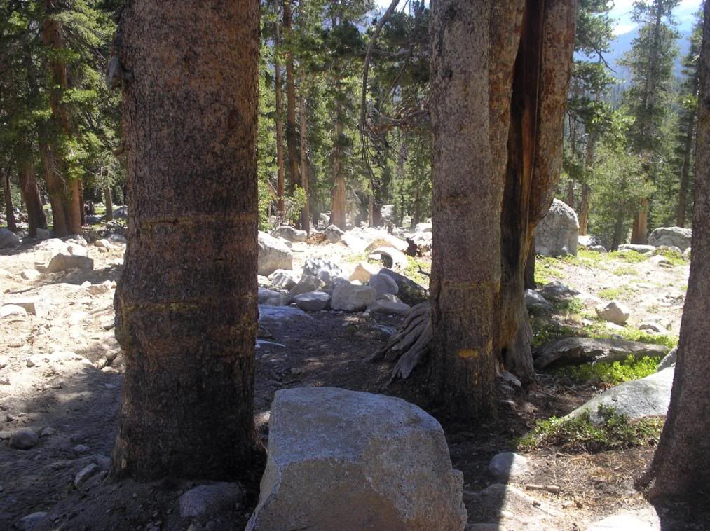
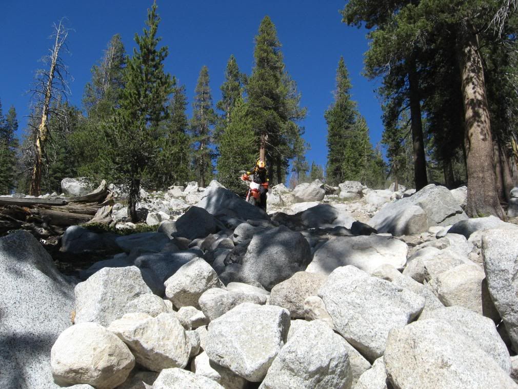
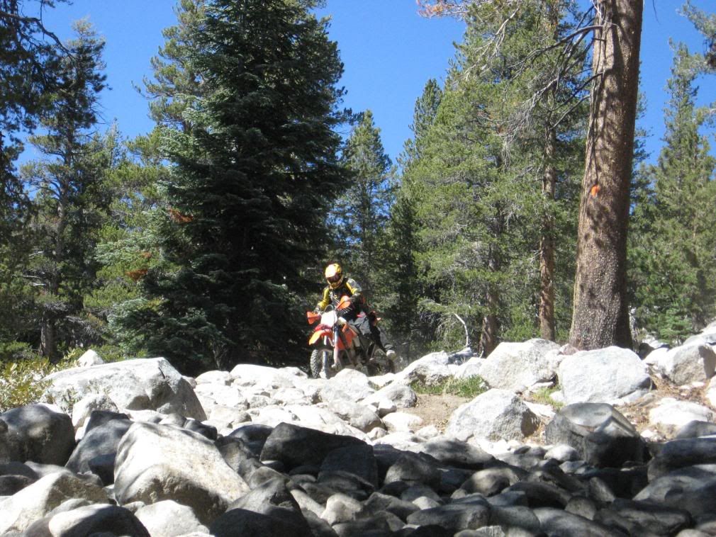
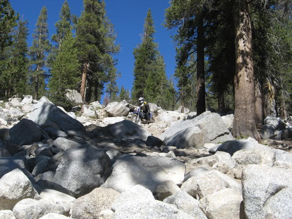
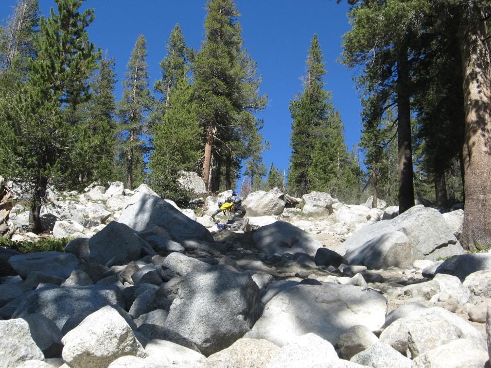
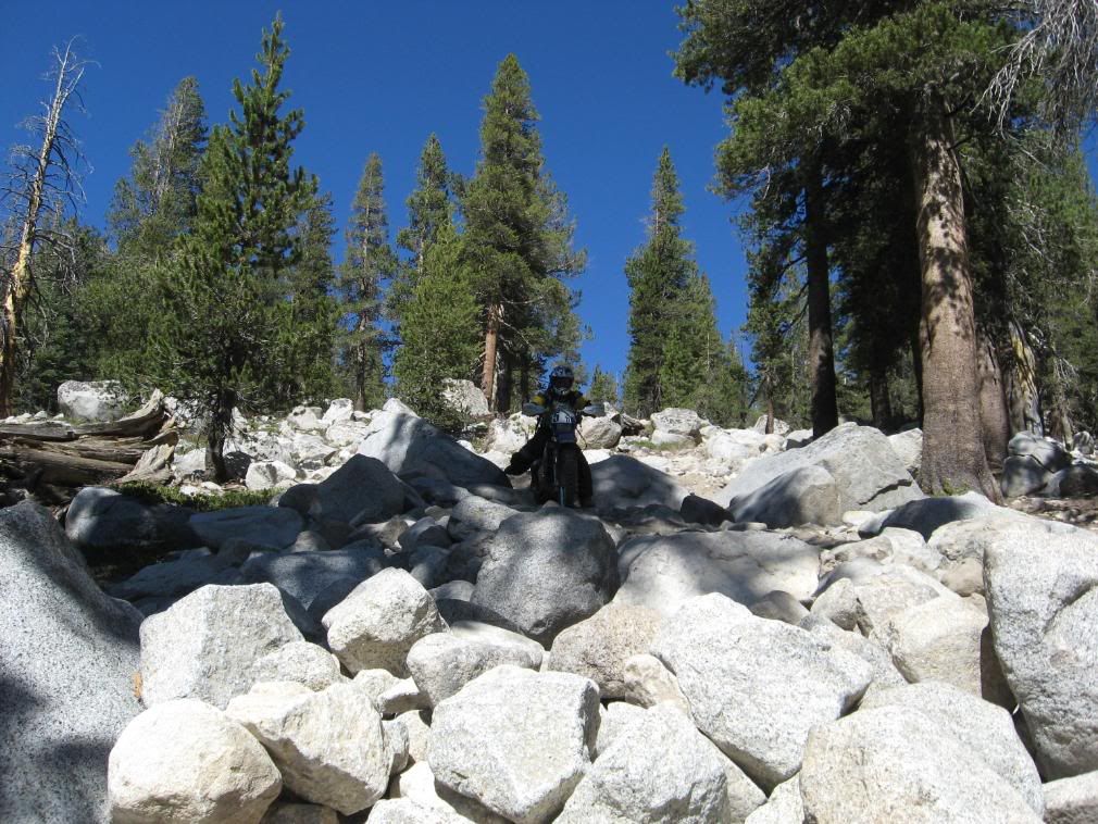
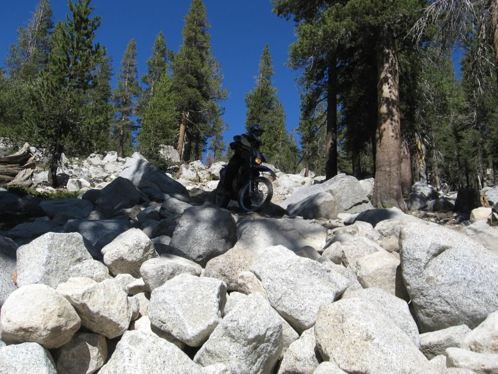
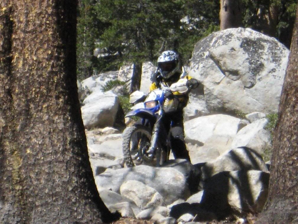
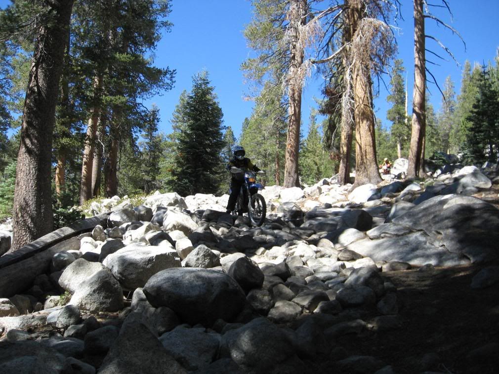
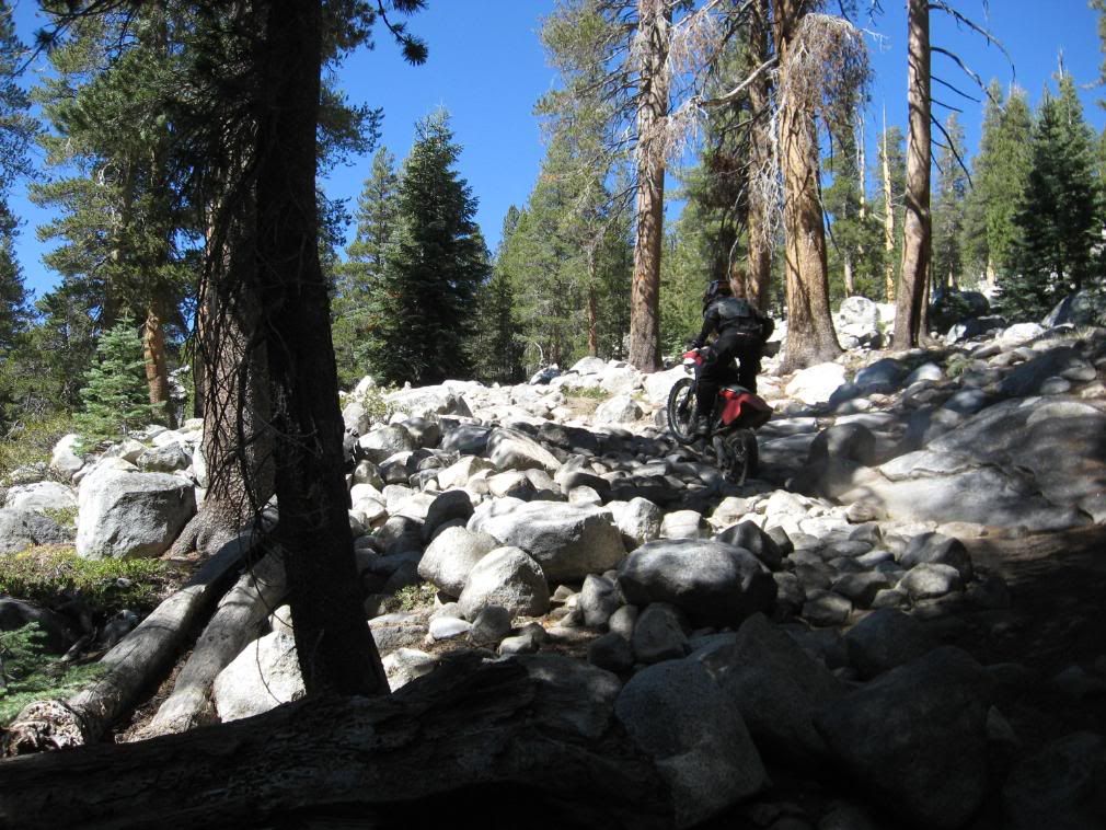
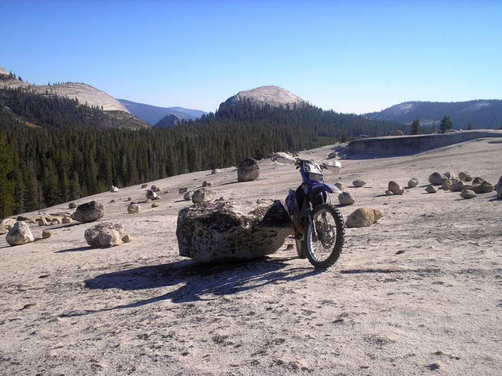
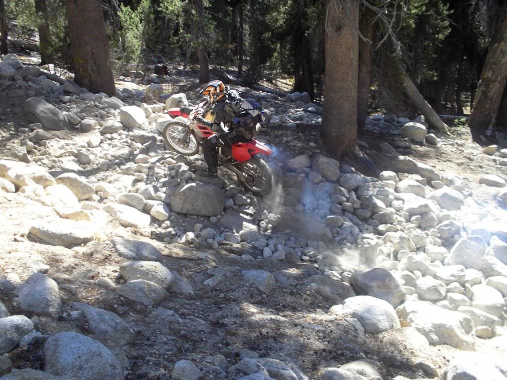
The trail is mostly rocks...

P9300048.jpg


P9300077.jpg


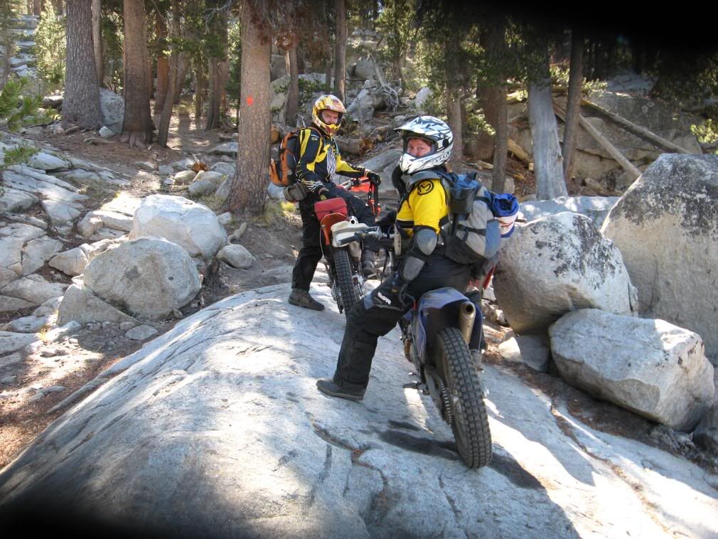
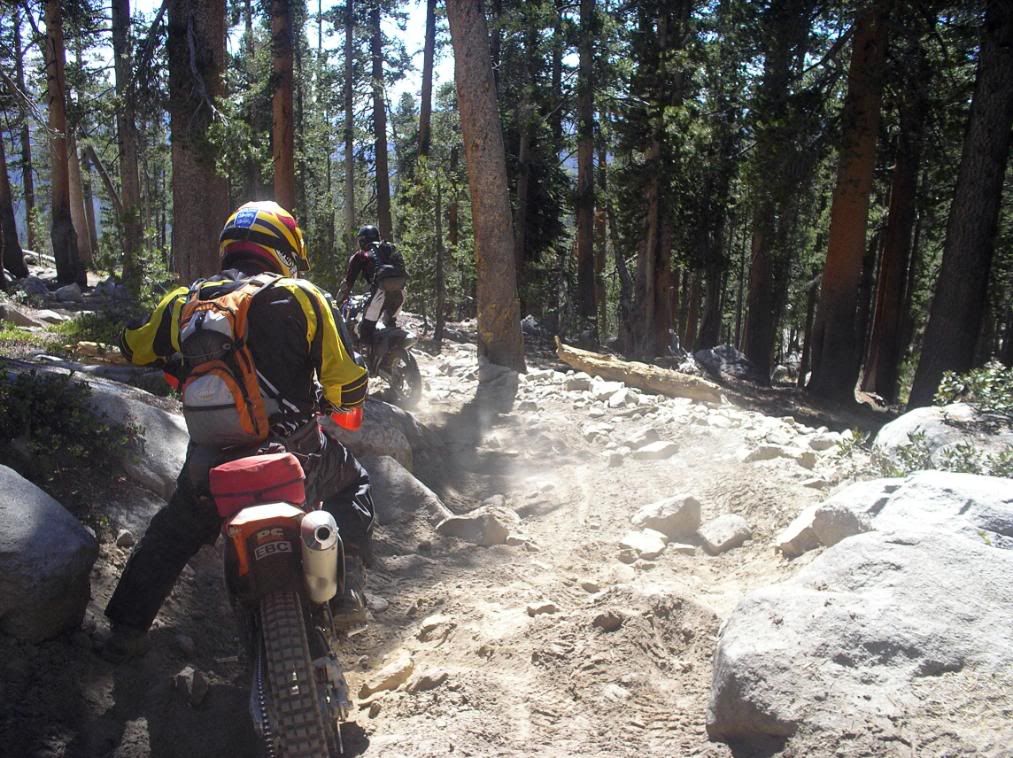
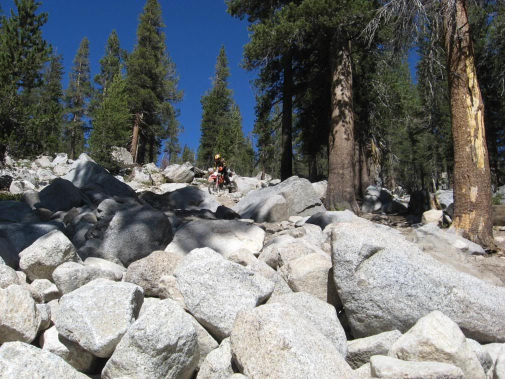
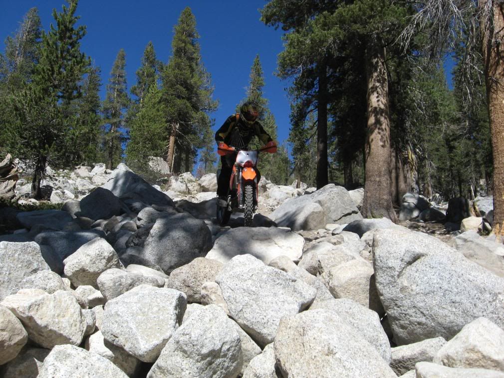
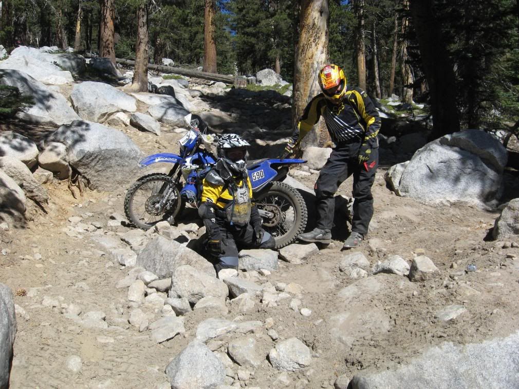
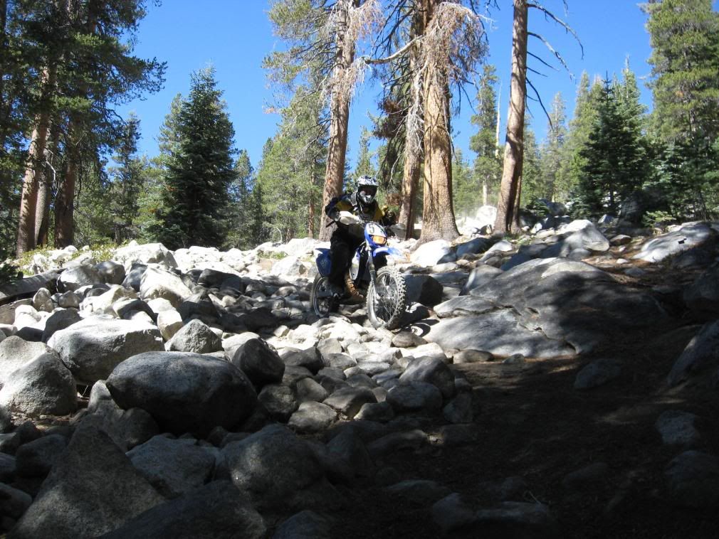
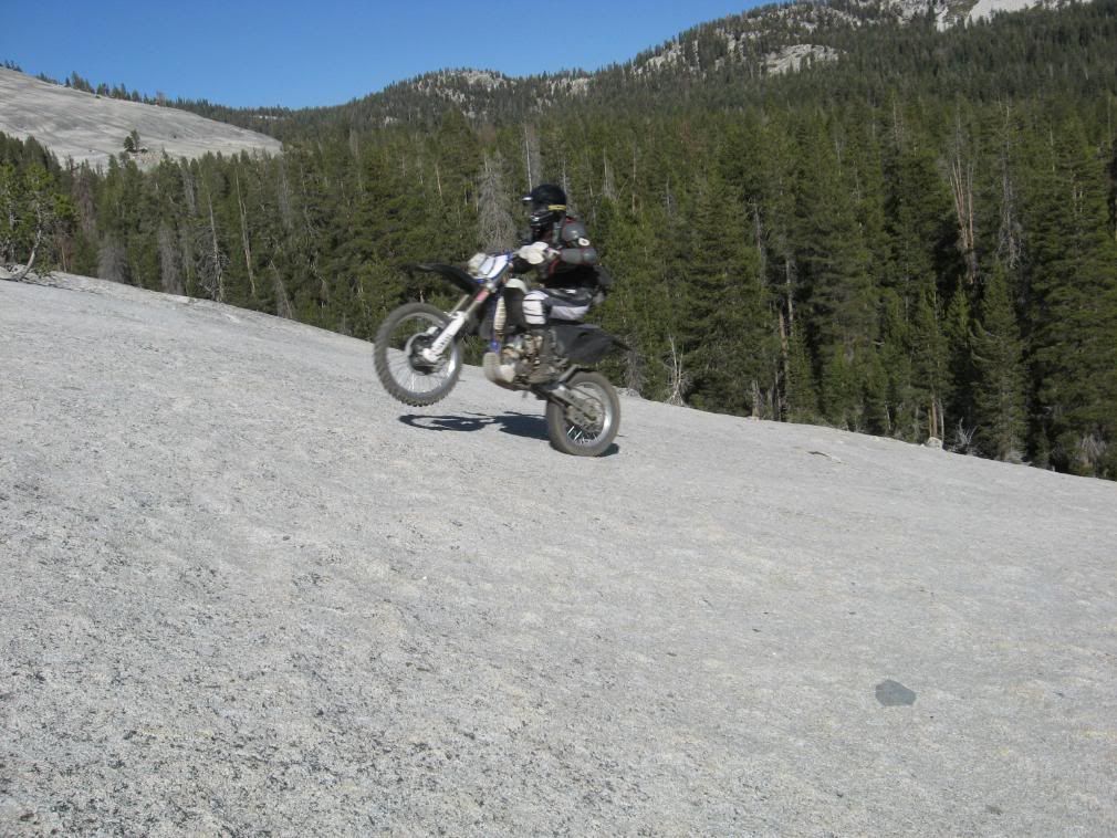
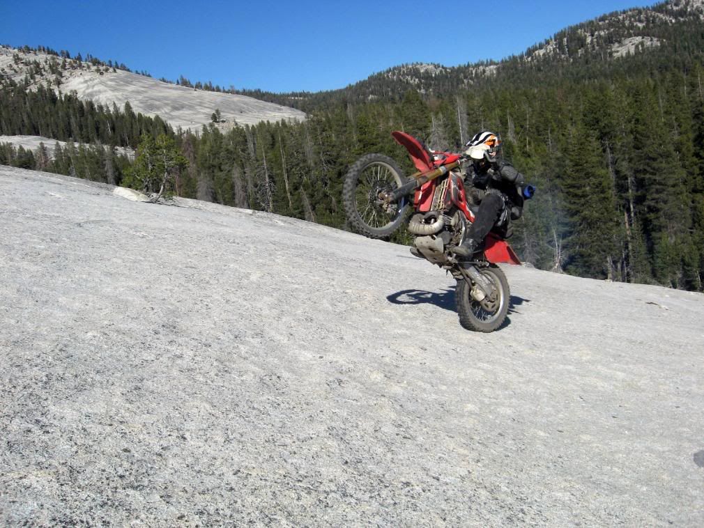
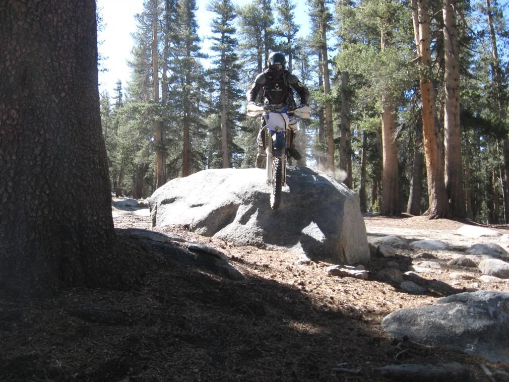
Screwing around in one of the many boulder gardens...

IMG_0266.jpg


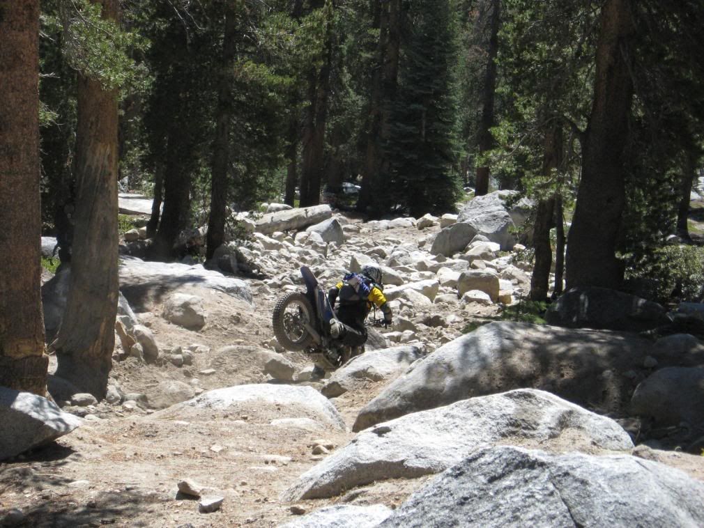
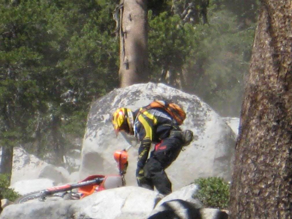
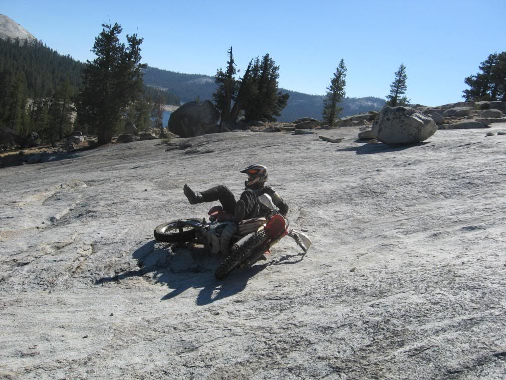
Steve, moments before losing traction and going down...

IMG_0257.jpg


To be continued...


WoodsChick
 

Ant

Pink Freud
Great pics! I miss the old days of dirt biking in the boonies:( If I may ask are you recovering from a moto accident?
 

WoodsChick

I Don't Do GPS
I took a different line...

IMG_0259.jpg


IMG_0260.jpg


IMG_0261.jpg


There are a couple of scenic lakes along the trail, but they are much prettier in the spring (mid-July) than they are later in the season...

IMG_0264.jpg


Summit Lake, which lies entirely within the John Muir Wilderness Area but is only 75 yards or so from the trail, is a good lunch spot. There were bear tracks all over the shore...

IMG_0268.jpg


The altitude tends to make this trail harder than it already is...

IMG_0269.jpg


After lunch we mosey on down the trail, knowing the hardest part is yet to come...

P9300054.jpg


P9300056.jpg


IMG_0328.jpg


To be continued...


WoodsChick
 

luckett

The Green Bastard
Nice! I want to do the Dusy sometime soon. Anyone want to ride it with me sometime in Sept.?
 

WoodsChick

I Don't Do GPS
When riding the trail from north to south, the looming spectre of Thompson Hill weighs heavily on the mind after a relaxing lunch. This is the hardest part of the trail, is it drops about 1200' in a very short distance. Courtright Reservoir is at the bottom. It is all rock, and most of the trees bear evidence of winch marks from jeeps winching themselves up it. This is Steve at the very top...

P9300059.jpg


Note the many marks on the trees...

P9300062.jpg


Steve on his way down...

IMG_0274.jpg


IMG_0275.jpg


IMG_0276.jpg


I missed the shot of Steve here, but I got Dan...

P9300066.jpg


Steve almost at the bottom...

P9300068.jpg


IMG_0307.jpg


To be continued...


WoodsChick
 

WoodsChick

I Don't Do GPS
OK, my turn now...

IMG_0278.jpg


IMG_0279.jpg


Ugh...not good...this is the easy part!

IMG_0280.jpg


IMG_0283.jpg


IMG_0284.jpg


Whew! Made it through the big rocks...

IMG_0285.jpg


Ok, this isn't so bad...hey, is that a drop off ahead?

IMG_0287.jpg


Yep, it's a drop-off, alright...

IMG_0288.jpg


Doh...

IMG_0289.jpg


No harm done. I dust myself off and continue on my way down.


To be continued...


WoodsChick
 

WoodsChick

I Don't Do GPS
Continuing on my way down Thompson Hill...

IMG_0300.jpg


IMG_0301.jpg


I wasn't the only one falling...

IMG_0302.jpg


IMG_0305.jpg


IMG_0306.jpg


I'm at the bottom!

IMG_0309.jpg


We sat and rested while Eric rode back up it, just to see how hard it would be for the next time when we go south-to-north...

IMG_0317.jpg


Eric on the way back up...

IMG_0310.jpg


He made it to within about 4' from the very top without stopping, but it totally kicked his butt. I'm not looking forward to the south-to-north route.
Well, maybe just a little bit...:ride


To be continued...


WoodsChick
 

trailjammer

'O.K. ...well, goodbye!'
Nice! I did that in my jeep last year in two days which everyone said couldn't be done. LOL 10 plus hours of wheel'en per day. Fun trail and tons of rocks. I should try it on a bike next time. Very challenging!
 

WoodsChick

I Don't Do GPS
After descending Thompson Hill, the trail follows the Dusy Creek drainage. Nothing too tough, but it is pretty rocky with some semi-tricky old log bridges across the creeks that are falling apart and/or kinda big and widely-spaced for dirtbikes. The jeeps don't seem to have any trouble with them, though.
This is also where the trail opens up and the scenery gets pretty spectacular, what with granite domes and such. Unfortunately, I didn't get a whole lot of scenic photos on this trip, but there are a ton of them in the first Dusy report linked in the first post here.

Maxson Dome, one of the many in the area...

IMG_0325.jpg


Towards the end of the trail lies Chicken Rock (Voyager Rock on maps) a large granite dome with a fairly steep descent. Traction is plentiful, though a bit more slidey than slickrock. It's a really fun place to screw around...

P9300091.jpg


P9300090.jpg


P9300085.jpg


P9300087.jpg


IMG_0339.jpg


IMG_0342.jpg


The opening in the trees below is the trail...

IMG_0336.jpg


IMG_0344.jpg


IMG_0346.jpg


The trail goes through a rock garden at the bottom and then continues for a few more miles, following the edge of Courtright Reservoir, and then ends at the parking area for the Maxson Dome Trailhead. We finished the 32-mile ride in about 6 hours or so, including lunch, all the time we goofed off up on the granite slab and in the boulder gardsn, and taking photos. It's a great trail, one of the most scenic and remote I've ever found in CA, and it's a lot of fun if you don't try to blaze through it in record time. It's worth it to stop and take in the beauty and be thankful that we can still ride this trail.

Hope you enjoyed the photos...


WoodsChick
 

WoodsChick

I Don't Do GPS
Great pics! I miss the old days of dirt biking in the boonies:( If I may ask are you recovering from a moto accident?

Thanks, glad you enjoyed them :thumbup

Not too many dirt photos here in the Moto Photo forum.:p

And yes, I shattered my ankle on the Big Boot trail ride north of Eureka...

Sorry this photo is so freakin' big...


Ankle1.jpg


WoodsChick
 

WoodsChick

I Don't Do GPS
Nice! I want to do the Dusy sometime soon. Anyone want to ride it with me sometime in Sept.?

Man, I'd love to do it in September:( Too bad all of my plans are on hold right
at the moment:( If you can do it sooner, I'd highly recommend it. The conditions are better the earlier you go, with lots of green and wildflowers everywhere.

There's a ton of fun to be had down there if you're on a plated bike. Lots of trails available for green sticker bikes, but they are all broken up and it's almost impossible to make a decent loop without riding illegally at some point.


WoodsChick
 

WoodsChick

I Don't Do GPS
Nice! I did that in my jeep last year in two days which everyone said couldn't be done. LOL 10 plus hours of wheel'en per day. Fun trail and tons of rocks. I should try it on a bike next time. Very challenging!

:laughing Yeah, they say 3 days is good for a jeep, but they also said it was not recommended for motorcycles:rolleyes The ranger I talked to said they get very little 2-wheel traffic on the Dusy. I've never seen other bikes on it, even though I know of folks that have done it. We didn't even see any jeeps on this trip. Next trip will include the Swamp Trail.

Yeah, it's challenging, but it's not necessarily the terrain that makes it so. It's a combination of factors, least of which is the remoteness and the fact that there are no easy ways to get out, especially if there are any injuries or whatnot; either you go back the way you came or you soldier on til the finish. Not too many places to land a helicopter, that's for sure. And, unlike the Rubicon, there are no easy go-arounds for the tough stuff. The altitude doesn't help either, especially for this sea-level dweller.

I think I'd be afraid to do it on 4 wheels:wow Did you go south-to-north or the opposite?


WoodsChick
 

AGOODHI

Member
awesome!!! :thumbup i always wanted to do that trail in my TJ.

btw, what kind of trials rubber are you guys running and what psi for that trail?

--ry
 

WoodsChick

I Don't Do GPS
Very nice! I wonder how my 300LBS Husky would have done there.:wtf

Wow...I don't know. I wouldn't want to ride my SM610 through there, that's for sure, and it's pretty much set up for the dirt. Hell, I don't even want to ride my 450 EXC there! I'm probably much smaller than you, though...I'm of the mind that the perfect ride for the Dusy is a lightweight 2-stroke. My bike only weighs 200#, yet picking it up at over 10000' made it feel somewhat heavier:)

A friend of mine is a very accomplished trials rider, and he makes his LC4
640e move like nobody's business on a trail, but he ended up turning around a few miles into it and decided to wait til he got himself something smaller.

Your mileage may vary, of course:teeth


WoodsChick
 

WoodsChick

I Don't Do GPS
awesome!!! :thumbup i always wanted to do that trail in my TJ.

btw, what kind of trials rubber are you guys running and what psi for that trail?

--ry

I'm pretty sure we were all running IRC Trials Winners (sometimes called
TR-11's, I think.) The 2 GasGas's were, anyway. We run tubeless-type tires with HD tubes. I usually run about 8psi for picking my way through the nasty, or 10psi if I'm going to be trying to make time and hitting rocks hard, such as in an enduro. I ran 10psi for this trip, due to the huge amount of rocks and sharp pointy bits, and the desire to avoid having to fix a flat out there. Eric was running 12psi, and he usually drops to 10 in the places where I run 8. Don't know about the other two, but we're all usually about the same so I'm guessing they were at 12, too. They all outweigh me and my bike significantly, hence my lower psi.

The trials tire is perfect for this trail. I've been running a rear trials tire for years, but it looks like the world is catching on. They are like cheating and will make you feel like an enduro hero in the rocks and roots:thumbup

WoodsChick
 
Top