You are using an out of date browser. It may not display this or other websites correctly.
You should upgrade or use an alternative browser.
You should upgrade or use an alternative browser.
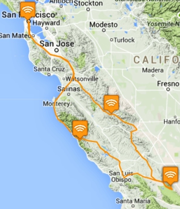
Clear Creek, Carrizo Plain, Coast Ridge ...
- Thread starter SFMCjohn
- Start date
SFMCjohn
13
When I got to Hollister Hills at 4 pm the ranger-lady was still at the gaurd shack
looking for $5 at the bitter end of a long holiday weekend ... I kept rolling
south toward the new, free, campsites along Coalinga Road near the
entrance to Clear Creek ...
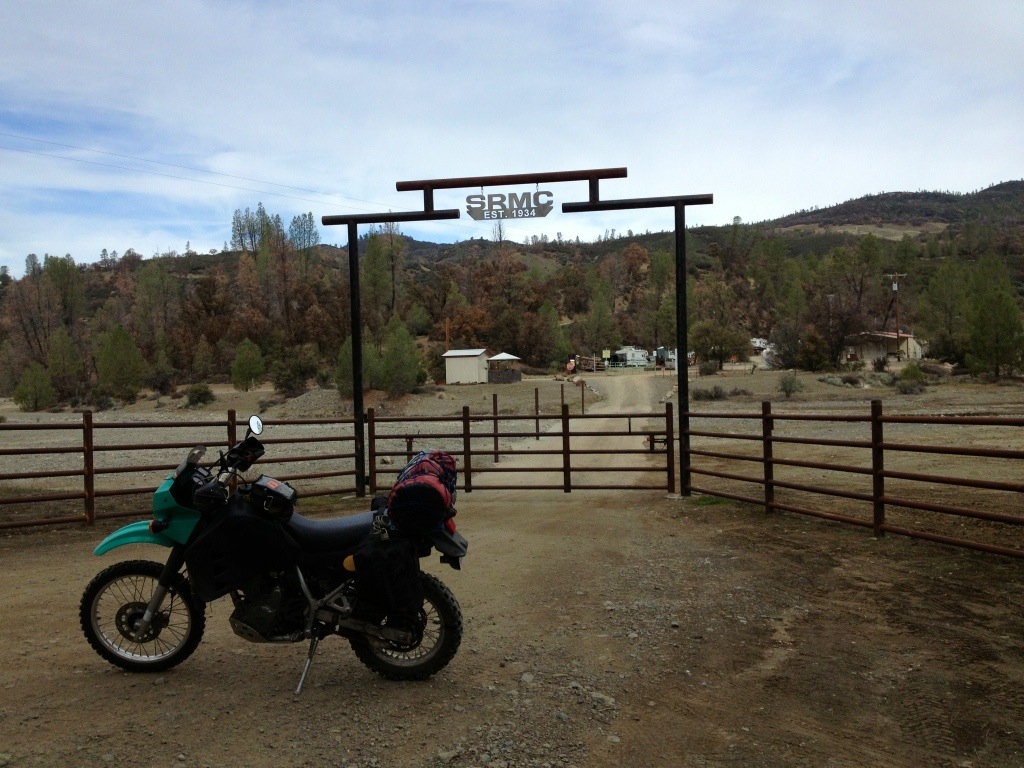
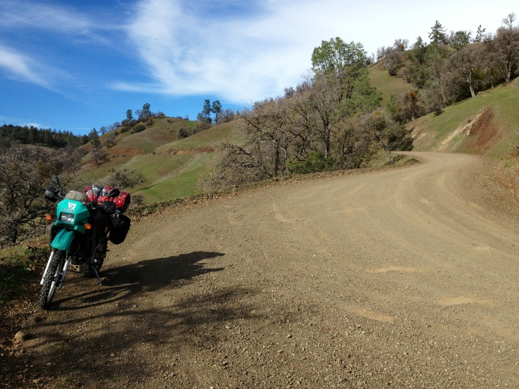
The gate to the Salinas Rambler Motorcycle Club on Coalinga Road ...
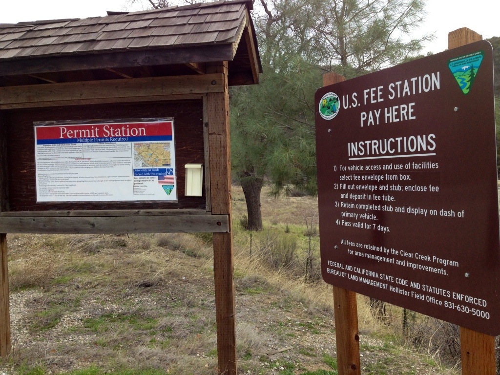
The new iron ranger station at Clear Creek ... the signs say you can't get all the permits you need here ... :laughing
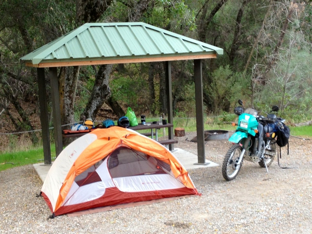
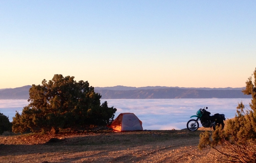
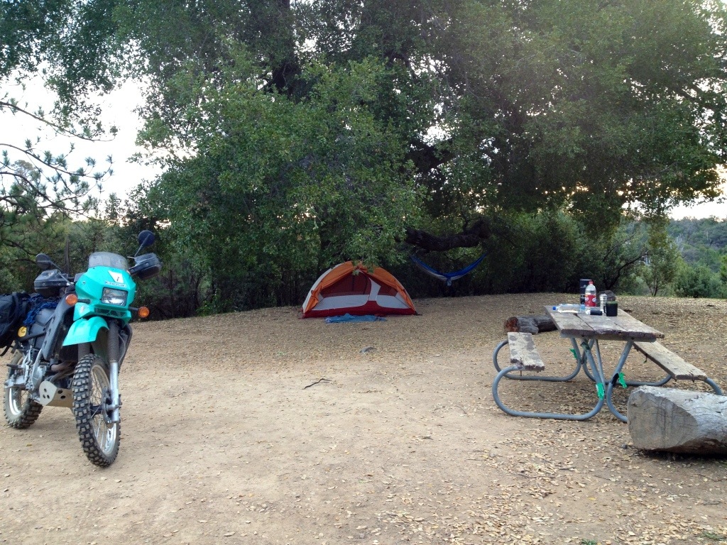
I had the first of the three new BLM campgrounds on Coalinga Road to myself ...
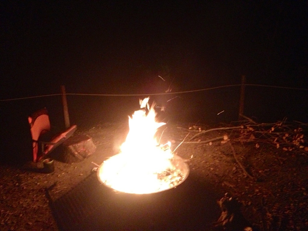
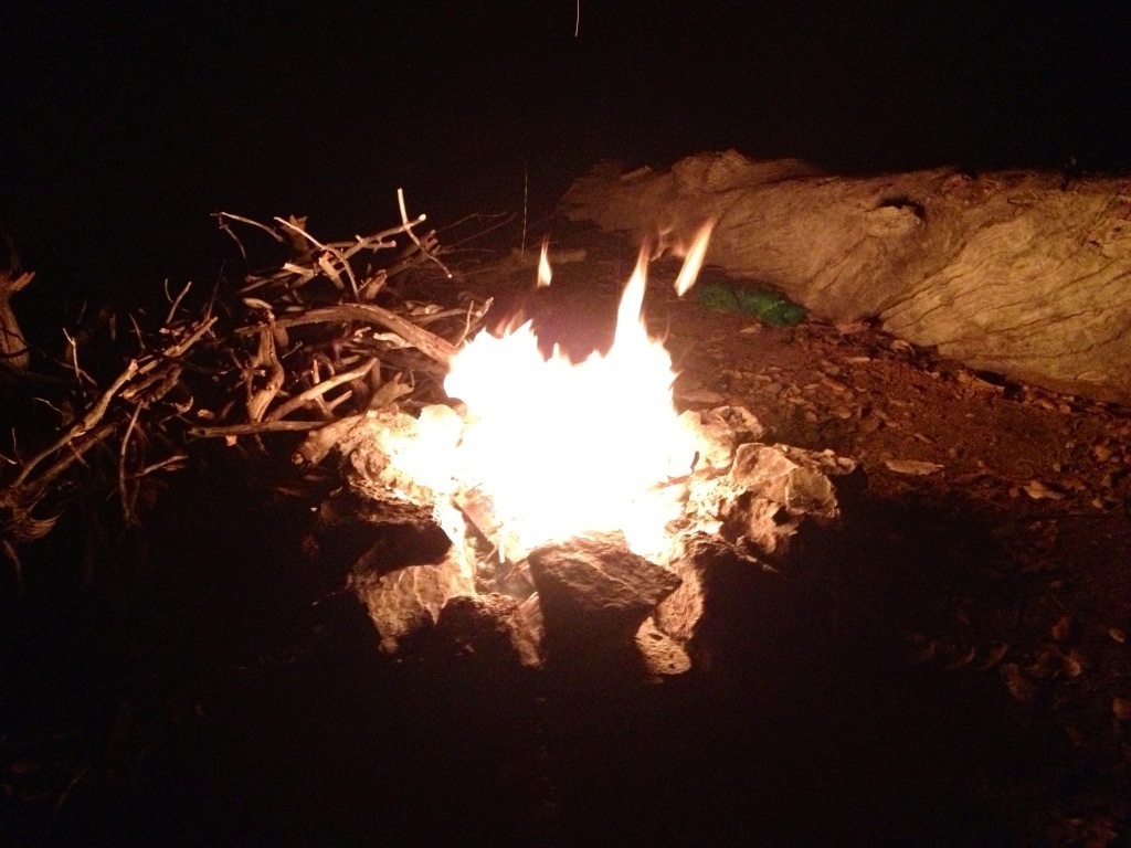
Lots of wood for a campfire ... does not look like these campgrounds
are seeing much use yet ... nice streetbike campground, just off the paved road ...
looking for $5 at the bitter end of a long holiday weekend ... I kept rolling
south toward the new, free, campsites along Coalinga Road near the
entrance to Clear Creek ...
The gate to the Salinas Rambler Motorcycle Club on Coalinga Road ...
The new iron ranger station at Clear Creek ... the signs say you can't get all the permits you need here ... :laughing
I had the first of the three new BLM campgrounds on Coalinga Road to myself ...
Lots of wood for a campfire ... does not look like these campgrounds
are seeing much use yet ... nice streetbike campground, just off the paved road ...
Last edited:
SFMCjohn
13
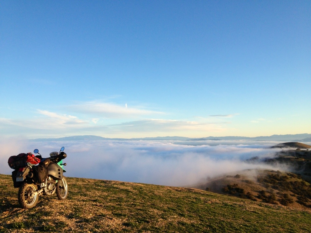
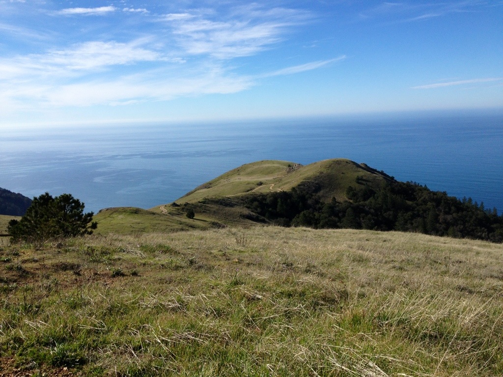
Hurricane Ridge ...
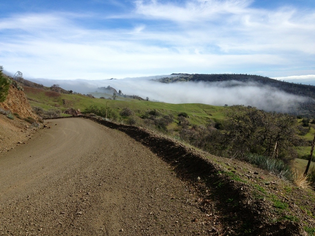
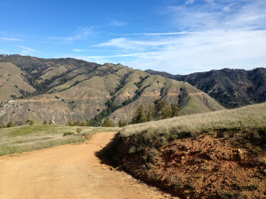
I was soon on Elkhorn Road, making the left onto Hurricane Road
and riding up through the fog and off the Carrizo Plain ...
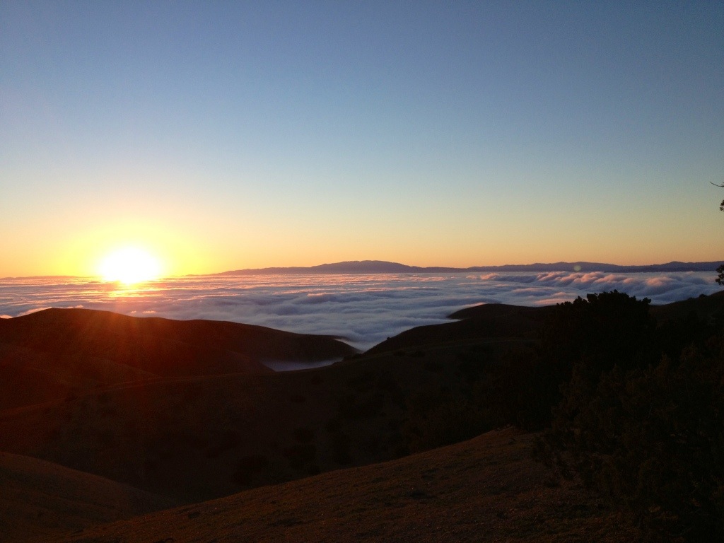
I love to camp up here, when the weather cooperates, because it's one of those
wonderful places where you can catch the sunset and the sunrise from
the same spot ...

The Tule fog was a trip ... when I was riding up through it I could
barely see where the road was going ...
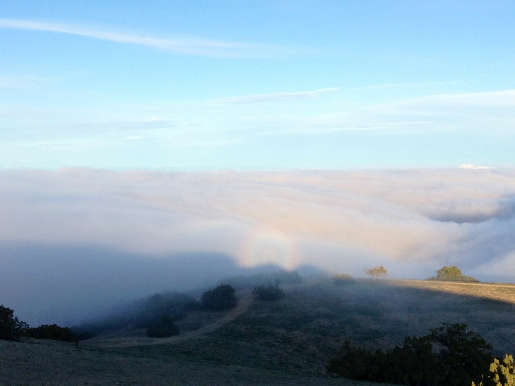
Sun-dog type rainbows in the fog cast from the setting sun ...
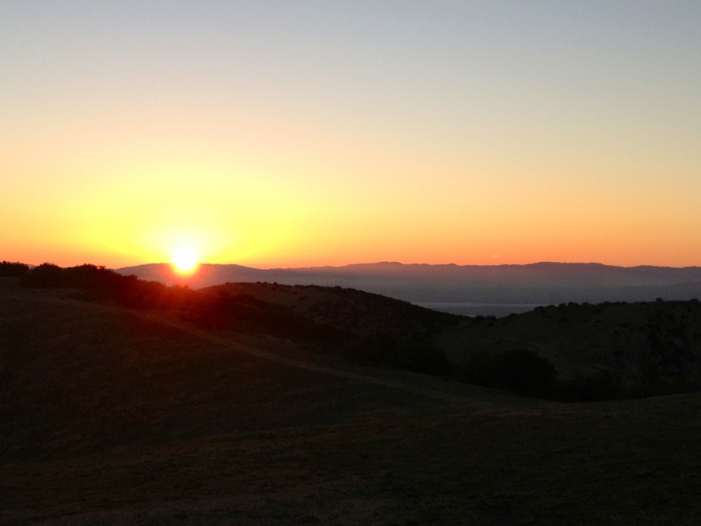
And the sunset ... you can just make out Soda Lake ...
I was soon on Elkhorn Road, making the left onto Hurricane Road
and riding up through the fog and off the Carrizo Plain ...
I love to camp up here, when the weather cooperates, because it's one of those
wonderful places where you can catch the sunset and the sunrise from
the same spot ...
The Tule fog was a trip ... when I was riding up through it I could
barely see where the road was going ...
Sun-dog type rainbows in the fog cast from the setting sun ...
And the sunset ... you can just make out Soda Lake ...
Last edited:
RightCoastBias
F8TRED
This is awesome. Looking forward to rides like this on my new bike!
Thanks for sharing!
Thanks for sharing!
Nemo Brinker
Tonight we ride
Hell yes! Thanks for the hot tip on the new campgrounds on Coalinga Road--I shall be checking them out stat.
And man--Hurricane Ridge Road is just strangely delightful. I even love that moment when you come up over the last ridge and get the sudden surreal vista of all the oil fields and the drill pads and the equipment pumping away.
Those fog shots you've got are like nothing I've ever seen!
And man--Hurricane Ridge Road is just strangely delightful. I even love that moment when you come up over the last ridge and get the sudden surreal vista of all the oil fields and the drill pads and the equipment pumping away.
Those fog shots you've got are like nothing I've ever seen!
SFMCjohn
13
This is awesome. Looking forward to rides like this on my new bike!
Thanks for sharing!
Hey RightCoastBias,
Your Beemer would love all of these
roads! Nice fire roads and they were dry
for the Scorpions ... :ride
Enjoyed your Fish Rock pics ... :thumbup
see you around the campfire,
-- SFMCjohn
SFMCjohn
13
Very nice!
Thanks, Rodr! :ride
SFMCjohn
13
Those fog pics are pretty rad!
Hi Momo-san,
Was reading the DV ride report in your sig,
have you had a chance to ride through Carrizo yet?
We use Taft as an overnight stop, too,
the motels are an adventure, ha! :ride
see you out there,
-- SFMCjohn
SFMCjohn
13
Hell yes! Thanks for the hot tip on the new campgrounds on Coalinga Road--I shall be checking them out stat.
And man--Hurricane Ridge Road is just strangely delightful. I even love that moment when you come up over the last ridge and get the sudden surreal vista of all the oil fields and the drill pads and the equipment pumping away.
Those fog shots you've got are like nothing I've ever seen!
Hi NB! :ride
There's three new campgrounds on Coalinga Road
just before and after Clear Creek, with maybe six
spots each ... the two further south have a bit of a view ...
I just love it up on Hurricane Ridge
when the wind isn't too bad ...
The fog was really fun ... pics can't capture
the way it was flowing over the ridge from
the CV and pouring into CP ...
... also saw one of the best wildflower displays
on HR a few seasons ago ... :thumbup
see you in an OHV park,
-- SFMCjohn
Last edited:
SFMCjohn
13
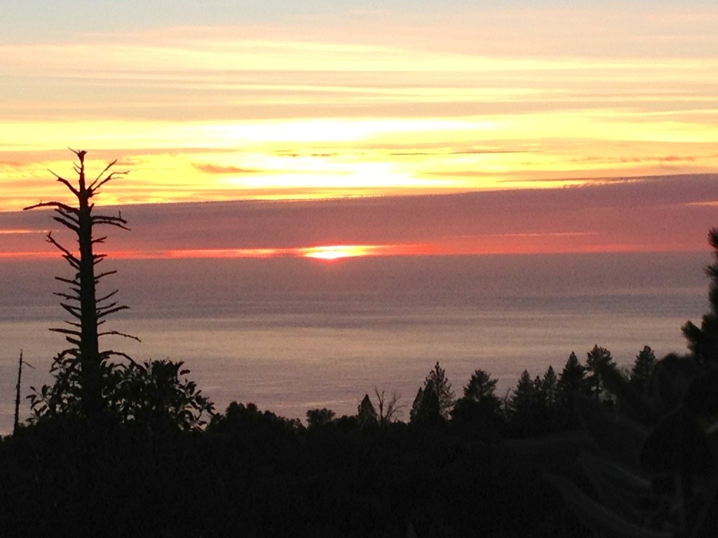
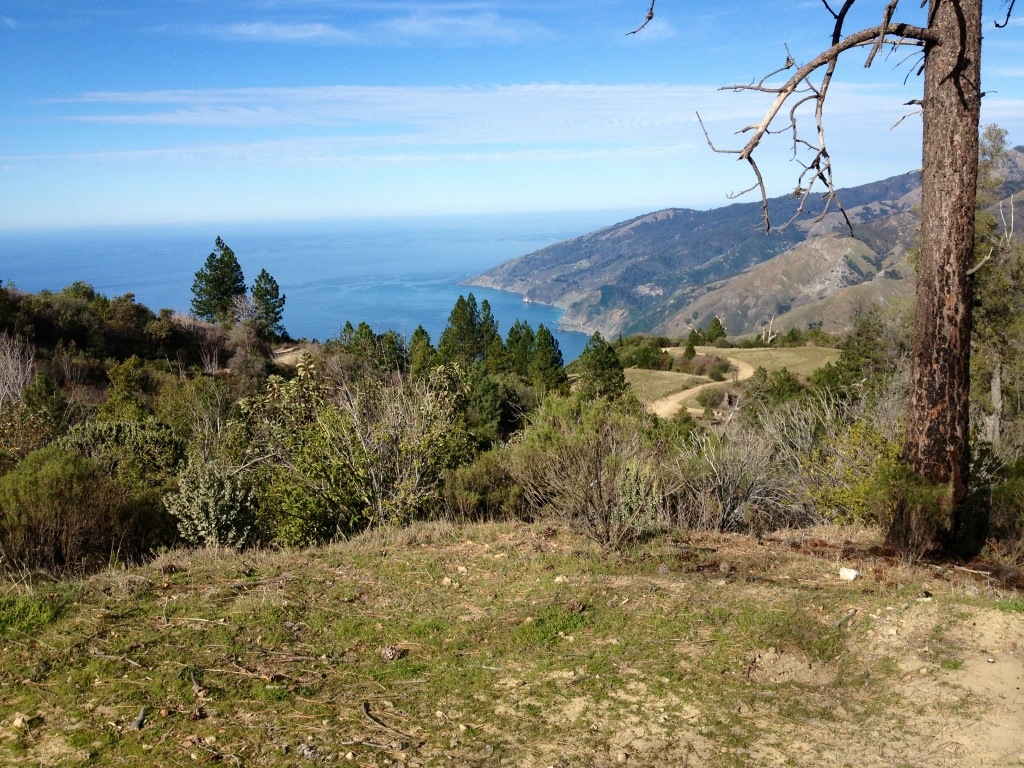
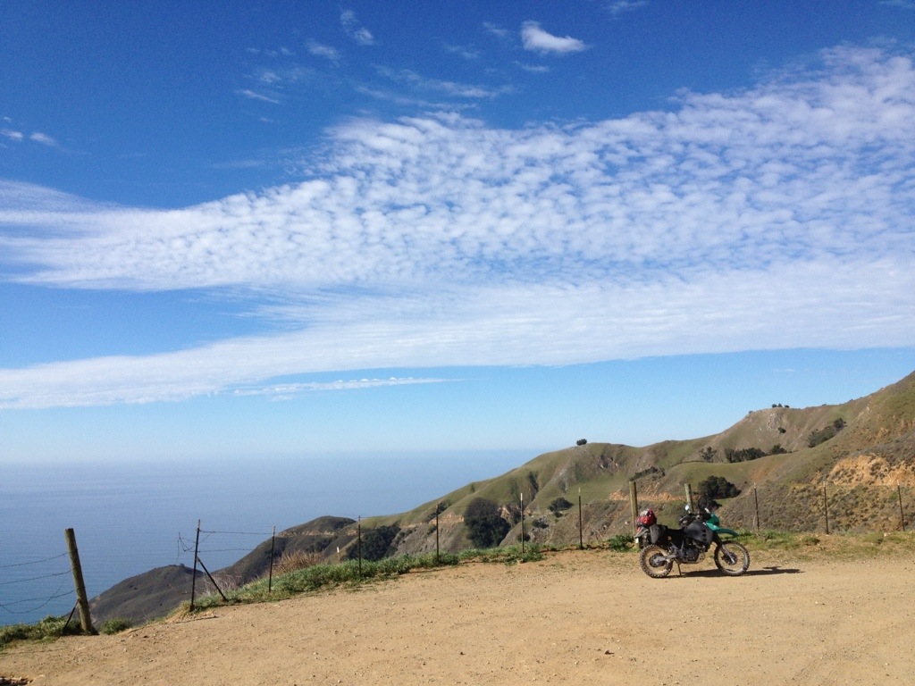
... and sunset over the Pacific Ocean ...
I'd been reading and seeing pics on-line of the fire-roads off
the Coast Trail for years and hearing from my
motorcycle buddies that the camping up there
is spectacular ... I only saw a small bit of the area on this trip,
so I'm looking forward to getting back there and exploring
a
bit
more ... :ride
see you around the campfire,
-- SFMCjohn
SFMCjohn
13
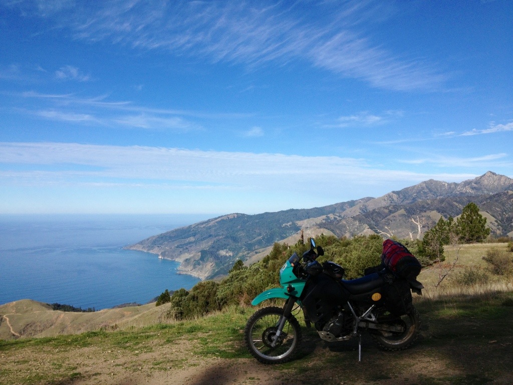
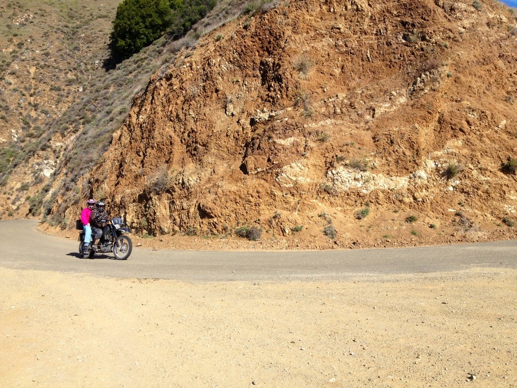
Here's a pic of my AAA map of Prewitt Ridge off South Coast Ridge Road ...
which was the area where my campsite was ...
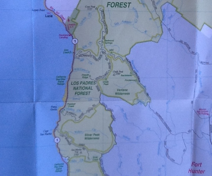
... it mainly shows the crossroad at Nacimiento-Fergusson Road and
the Central and South Coast Ridge Roads ... arty
arty
Probably going to try to check out the
Tassajara Hot Springs next time ...
Looks like my best bet for a visit to THS is a Day Visit after May 1st ...?
We'll see, I guess ... :ride
which was the area where my campsite was ...
... it mainly shows the crossroad at Nacimiento-Fergusson Road and
the Central and South Coast Ridge Roads ...
artyProbably going to try to check out the
Tassajara Hot Springs next time ...
Looks like my best bet for a visit to THS is a Day Visit after May 1st ...?
We'll see, I guess ... :ride
Last edited:
WoodsChick
I Don't Do GPS
Wow! Your photos are gorgeous! Thanks for sharing! I love that area down there. The whole San Benito Valley is so beautiful right now, and there's never a bad time for the coast or the Plain arty
WoodsChick
artyWoodsChick
SFMCjohn
13
Wow! Your photos are gorgeous! Thanks for sharing! I love that area down there. The whole San Benito Valley is so beautiful right now, and there's never a bad time for the coast or the Plain
WoodsChick
Hey WC! :ride
Haha ... Had to look up San Benito Valley ... :laughing
"The San Benito River is a river on the Central Coast of California. From its headwaters southeast of Santa Rita Peak in the Diablo Range, it flows northwest between the Diablo Range and the Gabilan Range, traveling ... past Hollister, California, where it turns west into the San Juan Valley ..."
Thanks for the kind words about my cell phone pics ... easy to
snap nice ones when Mother Nature is putting on a show ...
artyBest to Eric,
-- SFMCjohn
Attachments
-
 image.jpg62.8 KB · Views: 12
Last edited: